Map of Genesee County, New York
Item Information
- Title:
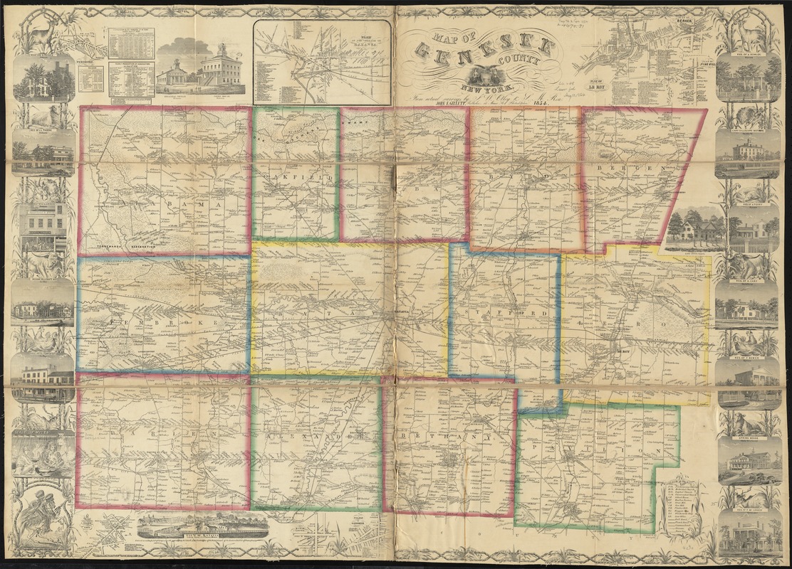
- Map of Genesee County, New York
- Creator:
- Otley, J. W.
- Name on Item:
-
from actual surveys by J.W. Otley & S.M. Rea.
- Date:
-
1854
- Format:
-
Maps/Atlases
- Location:
-
Boston Public Library
Norman B. Leventhal Map Center - Collection (local):
-
Norman B. Leventhal Map Center Collection
- Subjects:
-
Landowners--New York (State)--Genesee County--Maps
Real property--New York (State)--Genesee County--Maps
Genesee County (N.Y.)--Maps
- Places:
-
Genesee (county)
- Extent:
- 1 map : hand col. ; on sheet 102 x 137 cm.
- Terms of Use:
-
No known copyright restrictions.
No known restrictions on use.
- Publisher:
-
Philadelphia, Pa :
John E. Gillett [sic]
- Scale:
-
Scale [ca. 1:41,000]
- Language:
-
English
- Notes:
-
Shows town boundaries, roads, railroads, buildings, and houses labeled with owners' names.
Relief shown by hachures.
Includes statistics, key and vignettes.
Insets: Plan of the village of Batavia -- Plan of Le Roy -- Plan of Bergen -- Plan of Pine Hill -- Village of Cary -- Byron Center -- Village of Alexander.
- Identifier:
-
06_01_010643
- Call #:
-
G3803.G4 1854 .O85
- Barcode:
-
39999065676924


