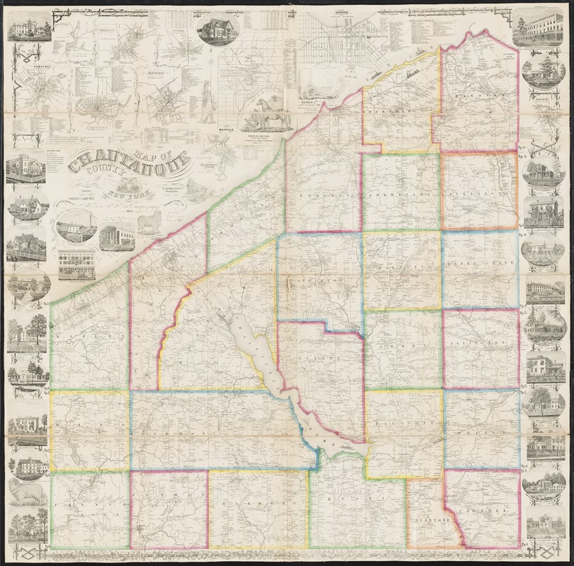
Map of Chautauque County, New York : from actual surveys
Item Information
- Title:
- Map of Chautauque County, New York : from actual surveys
- Creator:
- Rea, Samuel M.
- Name on Item:
-
by S. M. Rea & A.V. Tremble, surveyors of map of Chemunc County, N.Y.
- Date:
-
1854
- Format:
-
Maps/Atlases
- Location:
-
Boston Public Library
Norman B. Leventhal Map Center - Collection (local):
-
Norman B. Leventhal Map Center Collection
- Subjects:
-
Landowners--New York (State)--Chautauqua County--Maps
Real property--New York (State)--Chautauqua County--Maps
Chautauqua County (N.Y.)--Maps
- Places:
-
New YorkChautauqua (county)
- Extent:
- 1 map : hand colored ; 128 x 114 cm
- Terms of Use:
-
No known copyright restrictions.
No known restrictions on use.
- Publisher:
-
Philadelphia :
Publisher, Collins G. Keeney,
- Scale:
-
Scale approximately 1:53,000
- Language:
-
English
- Notes:
-
Shows landowners.
Relief shown by hachures.
Includes statistics and illustrations.
Ancillary maps: Forestville -- Fredonia -- Jamestown -- Panama -- Plan of Dunkirk -- Plan of Mayville -- Silver Creek Village -- Sinclearville -- Westfield.
- Identifier:
-
06_01_010635
- Call #:
-
G3803.C4 1854 .R43
- Barcode:
-
39999065676833
- LCCN:
-
2012593648


