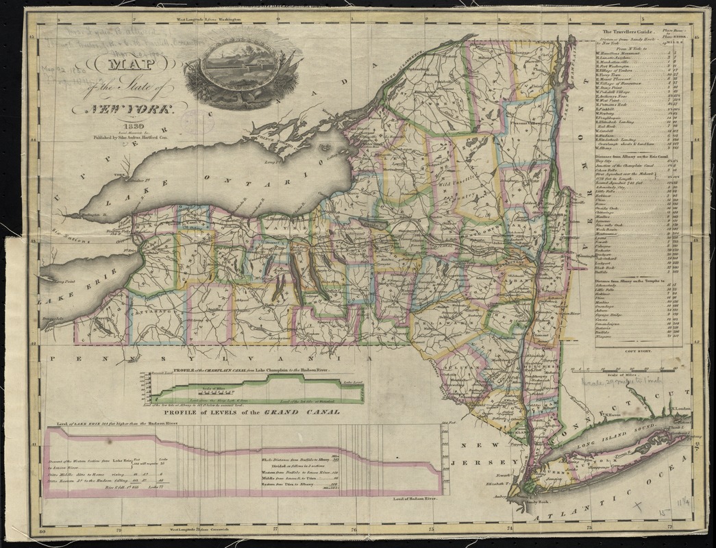
Map of the State of New York
Item Information
- Title:
- Map of the State of New York
- Creator:
- Andrus, Silas, 1789?-1861
- Name on Item:
-
Saml. Maverick sc.
- Date:
-
1830
- Format:
-
Maps/Atlases
- Location:
-
Boston Public Library
Norman B. Leventhal Map Center - Collection (local):
-
Norman B. Leventhal Map Center Collection
- Subjects:
-
New York (State)--Maps
New York (State)--Administrative and political divisions--Maps
Erie Canal (N.Y.)--Altitudes--Charts, diagrams, etc
Champlain Canal (N.Y.)--Altitudes--Charts, diagrams, etc
- Places:
-
Champlain Canal
Erie Canal
- Extent:
- 1 map : hand col., mounted on linen ; 30 x 39 cm., folded in cover 11 x 7 cm.
- Terms of Use:
-
No known copyright restrictions.
No known restrictions on use.
- Publisher:
-
Hartford, Con :
Silas Andrus
- Scale:
-
Scale [ca. 1:1,850,000]
- Language:
-
English
- Notes:
-
Prime meridians: Washington and Greenwich.
Includes "Travellers guide" mileage charts, and elevation profiles of the Erie and Champlain Canals and illustration.
- Identifier:
-
06_01_010609
- Call #:
-
G3800 1830 .A53
- Barcode:
-
39999065675447


