Driving map of Woodstock & vicinity, Vermont
Item Information
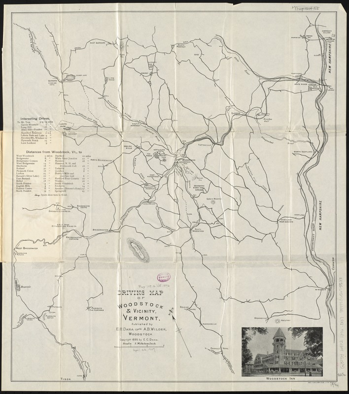
- Title:
- Driving map of Woodstock & vicinity, Vermont
- Title (alt.):
-
Road map of Woodstock, Vermont and vicinity
- Creator:
- Dana, E. C.
- Date:
-
[ca. 1896]
- Format:
-
Maps/Atlases
- Location:
-
Boston Public Library
Norman B. Leventhal Map Center - Collection (local):
-
Norman B. Leventhal Map Center Collection
- Subjects:
-
Roads--Vermont--Woodstock (Town)--Maps
Roads--Vermont--Maps
Woodstock (Vt. : Town)--Maps
- Places:
-
Windsor (county)Woodstock
- Extent:
- 1 map ; 57 x 50 cm.
- Terms of Use:
-
No known copyright restrictions.
No known restrictions on use.
- Publisher:
-
Woodstock, Vt :
E.C. Dana and A.B. Wilder
- Scale:
-
Scale [1:63,360]. 1 mile to an inch
- Language:
-
English
- Notes:
-
Shows roads, railroads, towns, schools, cemeteries, hotels, and other points of interest.
Oriented with north to the upper left.
Relief shown by hachures.
Includes tables of "interesting drives" and distances, and photograph of the Woodstock Inn.
- Identifier:
-
06_01_010599
- Call #:
-
G3754.W9P2 1896 .D36
- Barcode:
-
39999065675538


