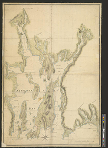
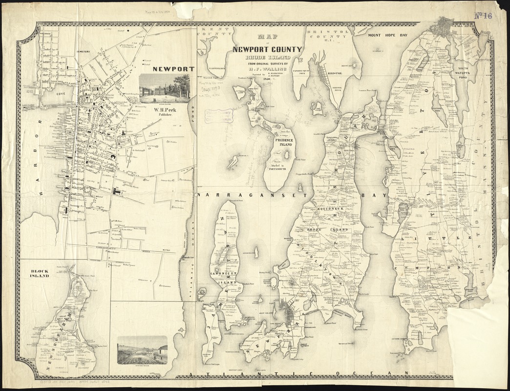
Map of Newport County, Rhode Island
Item Information
- Title:
- Map of Newport County, Rhode Island
- Creator:
- Walling, Henry Francis, 1825-1888
- Name on Item:
-
from original surveys by H.F. Walling ; assisted by O. Harkness [and] J. Hanson.
- Date:
-
1850
- Format:
-
Maps/Atlases
- Location:
-
Boston Public Library
Norman B. Leventhal Map Center - Collection (local):
-
Norman B. Leventhal Map Center Collection
- Subjects:
-
Landowners--Rhode Island--Newport County--Maps
Newport County (R.I.)--Maps
- Places:
-
Newport (county)
- Extent:
- 1 map ; 72 x 94 cm.
- Terms of Use:
-
No known copyright restrictions.
No known restrictions on use.
- Publisher:
-
S.l :
[H.F. Walling?]
- Scale:
-
Scale [ca. 1:44,000]
- Language:
-
English
- Notes:
-
Covers area north from Brenton's Reef to Mount Hope Bay and east from Warwick Neck to Bristol County. Shows names of landowners.
Relief shown by hachures.
Insets: Newport -- Block Island.
Includes 2 illustrations.
Boston Public Library copy imperfect: missing part of lower right corner.
- Identifier:
-
06_01_010555
- Call #:
-
G3773.N4 1850 .W35
- Barcode:
-
39999065675843