Map of Bristol County, Rhode Island
Item Information
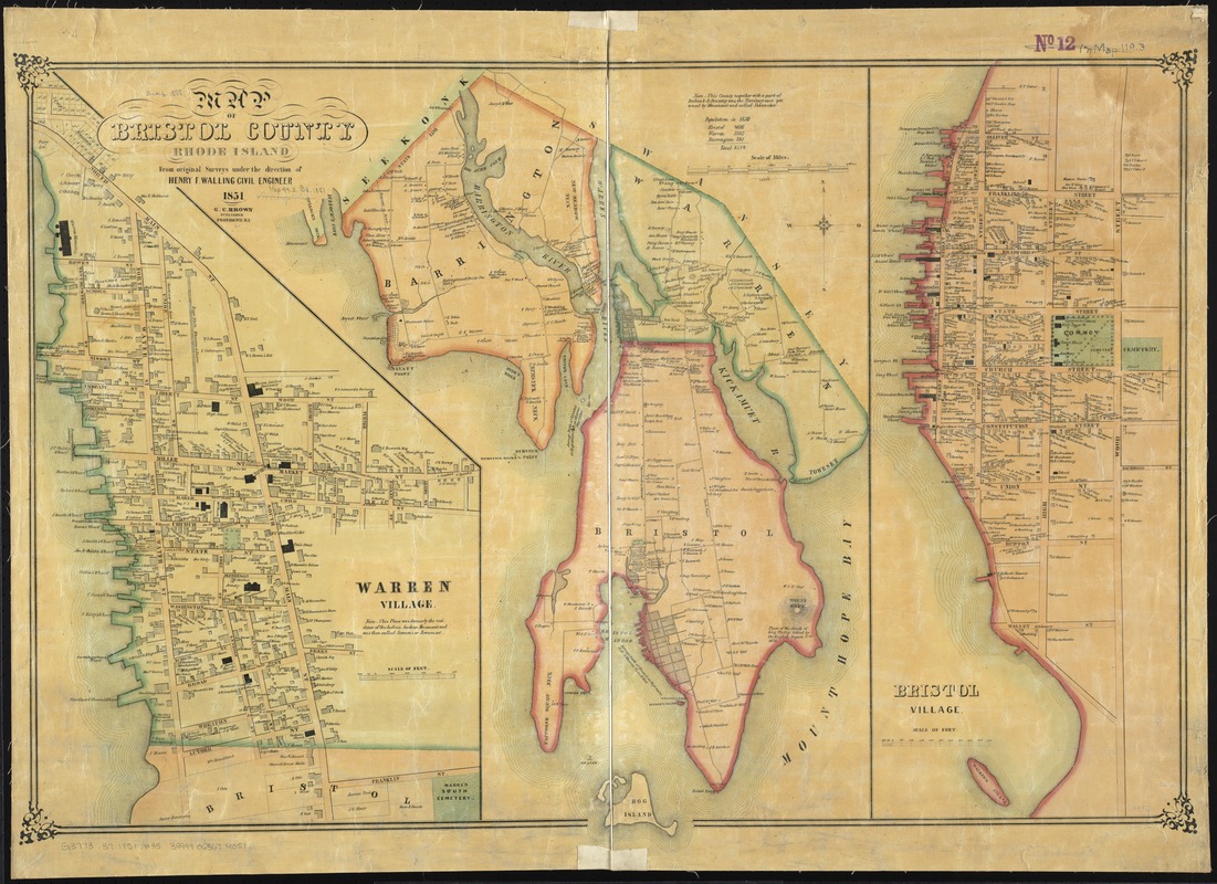
- Title:
- Map of Bristol County, Rhode Island
- Creator:
- Walling, Henry Francis, 1825-1888
- Name on Item:
-
from original surveys under the direction of Henry F. Walling, civil engineer.
- Date:
-
1851
- Format:
-
Maps/Atlases
- Location:
-
Boston Public Library
Norman B. Leventhal Map Center - Collection (local):
-
Norman B. Leventhal Map Center Collection
- Subjects:
-
Landowners--Rhode Island--Bristol County--Maps
Real property--Rhode Island--Bristol County--Maps
Bristol County (R.I.)--Maps
- Places:
-
Bristol (county)
- Extent:
- 1 map : col. ; 60 x 91 cm.
- Terms of Use:
-
No known copyright restrictions.
No known restrictions on use.
- Publisher:
-
Providence, R.I :
G.C. Brown
- Scale:
-
Scale 1:25,000
- Language:
-
English
- Notes:
-
Relief shown by hachures.
Insets: Warren Village -- Bristol Village.
Shows buildings, lots and landowners.
- Identifier:
-
06_01_010560
- Call #:
-
G3773.B7 1851 .W35
- Barcode:
-
39999065674051


