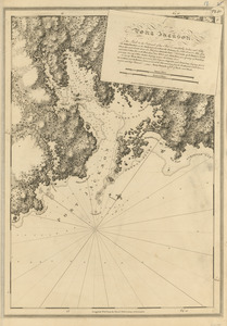
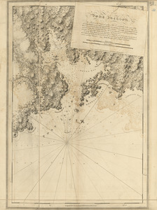
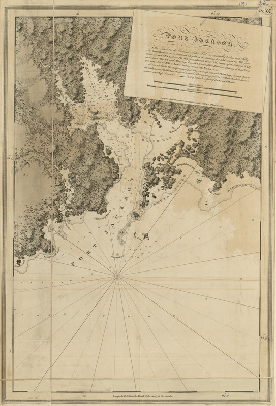
Port Jackson
This map is also available in American Revolutionary Geographies Online (ARGO), a collections portal especially built for material relating to the American Revolutionary War Era. Visit ARGO to learn more about this item and explore the historical geography of North America in the late eighteenth century.
Item Information
- Title:
- Port Jackson
- Publisher:
- Des Barres, Joseph F. W. (Joseph Frederick Wallet), 1722-1824
- Date:
-
1779
- Format:
-
Maps/Atlases
- Location:
- Library of Congress Geography and Map Division
- Collection (local):
-
Library of Congress Geography and Map Division
- Subjects:
-
Coasts--Nova Scotia--Maps
Port Jackson (N.S.)--Maps
Port Medway (N.S.)--Maps
- Places:
-
Port Medway
- Extent:
- 1 map : hand col. ; 74 x 54 cm.
- Terms of Use:
-
No known copyright restrictions.
This work is licensed for use under a Creative Commons Attribution Non-Commercial Share Alike License (CC BY-NC-SA).

- Publisher:
-
[London] :
J.F.W. Des Barres
- Scale:
-
Scale [ca. 1:29,000]
- Language:
-
English
- Catalog Record:
-
https://lccn.loc.gov/75332502
- Notes:
-
State 3. Date of imprint advanced to Feby. 30, 1779; plate number "Pl. 30" engraved in a small oval in the upper right; new settlements added near Eliza Pool, Point Lucy, and across Port Medway Harbor; and boundary lines of existing settlements strengthened.