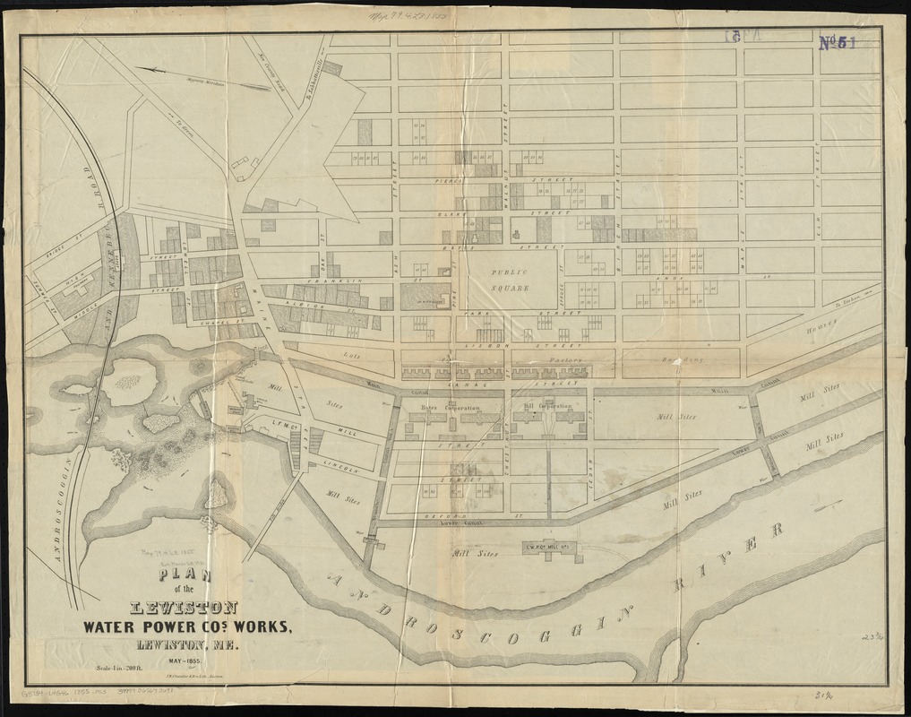
Plan of the Lewiston Water Power Co.'s works, Lewiston, Me
Item Information
- Title:
- Plan of the Lewiston Water Power Co.'s works, Lewiston, Me
- Date:
-
1855
- Format:
-
Maps/Atlases
- Location:
-
Boston Public Library
Norman B. Leventhal Map Center - Collection (local):
-
Norman B. Leventhal Map Center Collection
- Subjects:
-
Real property--Maine--Lewiston--Maps
Lewiston (Me.)--Maps
- Places:
-
Androscoggin (county)Lewiston
- Extent:
- 1 map ; 61 x 80 cm.
- Terms of Use:
-
No known copyright restrictions.
No known restrictions on use.
- Publisher:
-
Boston :
S.W. Chandler & Bro. Lith.
- Scale:
-
Scale [1:2,400]. 1 in. = 200 ft.
- Language:
-
English
- Notes:
-
Shows lots, mills, corporations, canals, and water currents.
Oriented with north to the left.
"May - 1855."
- Identifier:
-
06_01_010449
- Call #:
-
G3734.L4G46 1855 .P53
- Barcode:
-
39999065672691


