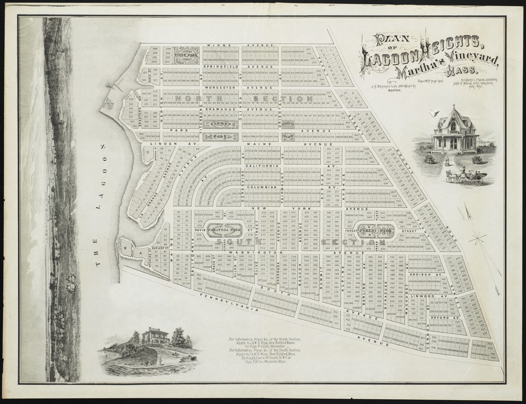
Plan of Lagoon Heights, Martha's Vineyard, Mass
Item Information
- Title:
- Plan of Lagoon Heights, Martha's Vineyard, Mass
- Creator:
- Pease, Richard L.
- Name on Item:
-
Richard L. Pease, surveyor ; John H. Mullin, civil engineer.
- Date:
-
[1873]
- Format:
-
Maps/Atlases
- Location:
-
Boston Public Library
Norman B. Leventhal Map Center - Collection (local):
-
Norman B. Leventhal Map Center Collection
- Subjects:
-
Lagoon Heights (Mass.)--Maps
- Places:
-
MassachusettsDukes (county)Martha's Vineyard (island)Oak BluffsLagoon Heights
- Extent:
- 1 map ; 65 x 86 cm.
- Terms of Use:
-
No known copyright restrictions.
No known restrictions on use.
- Publisher:
-
Boston :
J.H. Bufford's Lith.
- Scale:
-
Scale [1:1,920]. 160 ft. to an in.
- Language:
-
English
- Notes:
-
Cadastral map showing lot lines and numbers.
Oriented with north towards the upper left.
"Aug. 1873."
Includes 3 engraved vignettes.
- Notes (date):
-
This date is inferred.
- Identifier:
-
06_01_010375
- Call #:
-
G3764.L115 1873 .P4
- Barcode:
-
39999065671800
- LCCN:
-
91685206


