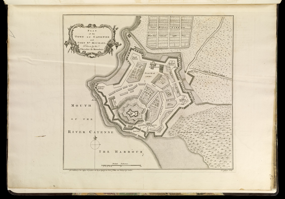
Plan of the town of Cayenne and Fort St. Michael
This map is also available in American Revolutionary Geographies Online (ARGO), a collections portal especially built for material relating to the American Revolutionary War Era. Visit ARGO to learn more about this item and explore the historical geography of North America in the late eighteenth century.
Item Information
- Title:
- Plan of the town of Cayenne and Fort St. Michael
- Creator:
- Marchais, R. de
- Contributor:
- Jefferys, Thomas, -1771
- Contributor:
- Sayer, Robert, 1725-1794
- Name on Item:
-
drawn by Chevalier de Mareechais ; T. Jefferys sculp.
- Date:
-
[1768]
- Format:
-
Maps/Atlases
- Location:
-
Boston Public Library
Norman B. Leventhal Map Center - Collection (local):
-
Norman B. Leventhal Map Center Collection
- Subjects:
-
Cayenne (French Guiana)--Maps--Early works to 1800
- Places:
-
French Guiana (territory)Cayenne
- Extent:
- 1 map ; 32 x 35 cm.
- Terms of Use:
-
No known copyright restrictions.
No known restrictions on use.
- Publisher:
-
London :
Thos. Jefferys
- Scale:
-
Scale [ca. 1:2,250]
- Language:
-
English
- Notes:
-
Relief shown by hachures.
Appears in Jefferys' General topography of North America and the West Indies. London: Printed for Robert Sayer, ... and Thomas Jefferys, 1768.
- Notes (date):
-
This date is inferred.
- Notes (citation):
-
Phillips. List of maps of America, p. 214
Phillips, 1196
- Identifier:
-
4000137_0118r
- Call #:
-
G1105 .J4 1768
- Barcode:
-
30000003257657