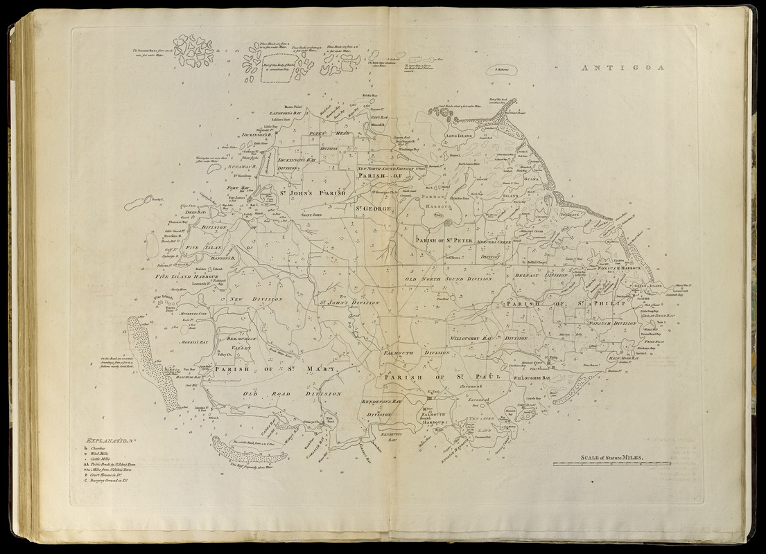
Antigoa
Item Information
- Title:
- Antigoa
- Creator:
- Jefferys, Thomas, -1771
- Publisher:
- Sayer, Robert, 1725-1794
- Date:
-
[1768]
- Format:
-
Maps/Atlases
- Location:
-
Boston Public Library
Norman B. Leventhal Map Center - Collection (local):
-
Norman B. Leventhal Map Center Collection
- Subjects:
-
Antigua--Maps--Early works to 1800
- Places:
-
Antigua and BarbudaAntigua (island)
- Extent:
- 1 map ; 50 x 65 cm.
- Terms of Use:
-
No known copyright restrictions.
No known restrictions on use.
- Publisher:
-
London :
Printed for Robert Sayer, ... and Thomas Jefferys
- Scale:
-
Scale [ca. 1:53,000]
- Language:
-
English
- Notes:
-
Shows cities, administrative divisions, churches, wind mills, cattle mills, harbors, and reefs.
Depths shown by soundings.
Appears in Jefferys' General topography of North America and the West Indies. London: Printed for Robert Sayer, ... and Thomas Jefferys, 1768.
- Notes (date):
-
This date is inferred.
- Notes (citation):
-
LC Maps of North America, 2002
Phillips, 1196
- Identifier:
-
4000137_0105
- Call #:
-
G1105 .J4 1768
- Barcode:
-
30000003256618


