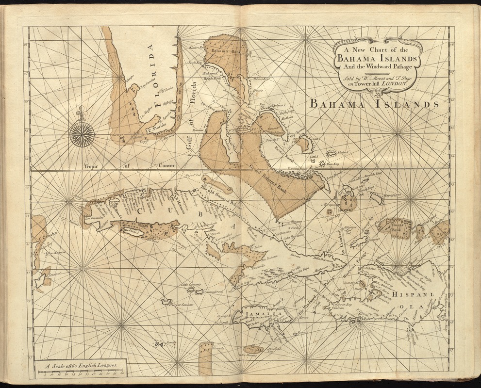
A new chart of the Bahama Islands and the Windward Passage
Item Information
- Title:
- A new chart of the Bahama Islands and the Windward Passage
- Creator:
- Thornton, John, 1641-1708
- Date:
-
[1737]
- Format:
-
Maps/Atlases
- Location:
-
Boston Public Library
Norman B. Leventhal Map Center - Collection (local):
-
Norman B. Leventhal Map Center Collection
- Subjects:
-
Nautical charts--West Indies--Early works to 1800
Bahamas--Maps--Early works to 1800
West Indies--Maps--Early works to 1800
- Places:
-
Bahamas
West Indies
- Extent:
- 1 map : hand col. ; 43 x 51 cm.
- Terms of Use:
-
No known copyright restrictions.
No known restrictions on use.
- Publisher:
-
London :
Sold by W. Mount and T. Page on Tower Hill
- Scale:
-
Scale [ca. 1:2,880,000]
- Language:
-
English
- Notes:
-
Relief shown pictorially. Depths shown by soundings.
In the English pilot, the fourth book. London : Printed for William Mount and Thomas Page, 1737.
- Notes (date):
-
This date is inferred.
- Identifier:
-
06_01_010279
- Call #:
-
G1106.P5 E54 1737
- Barcode:
-
30000003250858

![A new and improved chart of the West India or Carribbee [sic] Islands](https://bpldcassets.blob.core.windows.net/derivatives/images/commonwealth:kk91fq95z/image_thumbnail_300.jpg)

