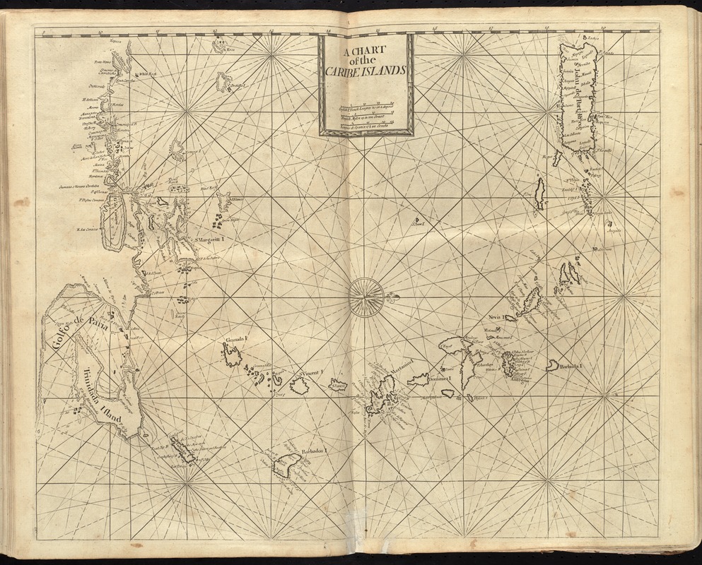
A chart of the Caribe Islands
Item Information
- Title:
- A chart of the Caribe Islands
- Creator:
- Thornton, John, 1641-1708
- Date:
-
[1737]
- Format:
-
Maps/Atlases
- Location:
-
Boston Public Library
Norman B. Leventhal Map Center - Collection (local):
-
Norman B. Leventhal Map Center Collection
- Subjects:
-
Nautical charts--Antilles, Lesser--Early works to 1800
Antilles, Lesser--Maps--Early works to 1800
- Places:
-
Lesser Antilles (area)
- Extent:
- 1 map ; 42 x 53 cm.
- Terms of Use:
-
No known copyright restrictions.
No known restrictions on use.
- Publisher:
-
London :
Printed & sold by Page and Mount
- Scale:
-
Scale [ca. 1:2,050,000]
- Language:
-
English
- Notes:
-
Depths shown by soundings.
Oriented with north to the right.
In the English pilot, the fourth book. London : Printed for William Mount and Thomas Page, 1737.
- Notes (date):
-
This date is inferred.
- Identifier:
-
06_01_010274
- Call #:
-
G1106.P5 E54 1737
- Barcode:
-
30000003250852

![[Alleen de Caribische Eilanden, vervat in 't groot]](https://bpldcassets.blob.core.windows.net/derivatives/images/commonwealth:st74cw59p/image_thumbnail_300.jpg)

