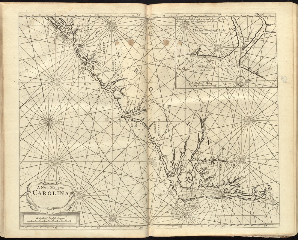
A new mapp of Carolina
Item Information
- Title:
- A new mapp of Carolina
- Title (alt.):
-
New map of Carolina
- Creator:
- Thornton, John, 1641-1708
- Date:
-
[1737]
- Format:
-
Maps/Atlases
- Location:
-
Boston Public Library
Norman B. Leventhal Map Center - Collection (local):
-
Norman B. Leventhal Map Center Collection
- Subjects:
-
Nautical charts--North Carolina--Early works to 1800
Nautical charts--South Carolina--Early works to 1800
North Carolina--Maps--Early works to 1800
South Carolina--Maps--Early works to 1800
Charleston (S.C.)--Maps--Early works to 1800
- Places:
-
North Carolina
Charleston (county)Charleston
- Extent:
- 1 map ; 41 x 52 cm.
- Terms of Use:
-
No known copyright restrictions.
No known restrictions on use.
- Publisher:
-
London :
John Thornton and Will: Fisher
- Scale:
-
Scale [ca. 1,140,000]
- Language:
-
English
- Notes:
-
Depth shown by soundings.
Oriented with north to the right.
Inset: A large draught of Ashly and Coopers River.
Later state in which the imprint has been roughly erased and there are more rhumb lines.
In the English pilot, the fourth book. London : Printed for William Mount and Thomas Page, 1737.
- Notes (date):
-
This date is inferred.
- Identifier:
-
06_01_010272
- Call #:
-
G1106.P5 E54 1737
- Barcode:
-
30000003249889


