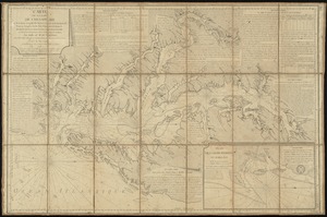
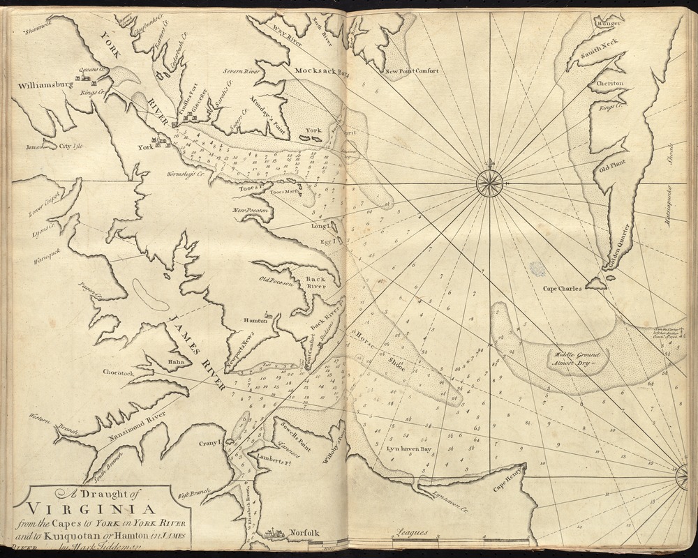
A draught of Virginia from the Capes to York in York River and to Kuiquotan or Hamton in James River
Item Information
- Title:
- A draught of Virginia from the Capes to York in York River and to Kuiquotan or Hamton in James River
- Creator:
- Tiddeman, Mark.
- Name on Item:
-
by Mark Tiddeman.
- Date:
-
[1737]
- Format:
-
Maps/Atlases
- Location:
-
Boston Public Library
Norman B. Leventhal Map Center - Collection (local):
-
Norman B. Leventhal Map Center Collection
- Subjects:
-
Nautical charts--Chesapeake Bay (Md. and Va.)--Early works to 1800
Coasts--Virginia--Maps--Early works to 1800
Chesapeake Bay (Md. and Va.)--Maps--Early works to 1800
Maryland--Maps--Early works to 1800
Virginia--Maps--Early works to 1800
- Places:
-
Chesapeake Bay
Virginia
- Extent:
- 1 map ; 46 x 58 cm.
- Terms of Use:
-
No known copyright restrictions.
No known restrictions on use.
- Publisher:
-
London :
Printed & sold by Page and Mount
- Scale:
-
Scale [ca. 1:125,000]
- Language:
-
English
- Notes:
-
Depths shown by soundings.
In the English pilot, the fourth book. London : Printed for William Mount and Thomas Page, 1737.
- Notes (date):
-
This date is inferred.
- Identifier:
-
06_01_010269
- Call #:
-
G1106.P5 E54 1737
- Barcode:
-
30000003249886