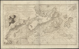
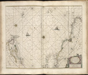
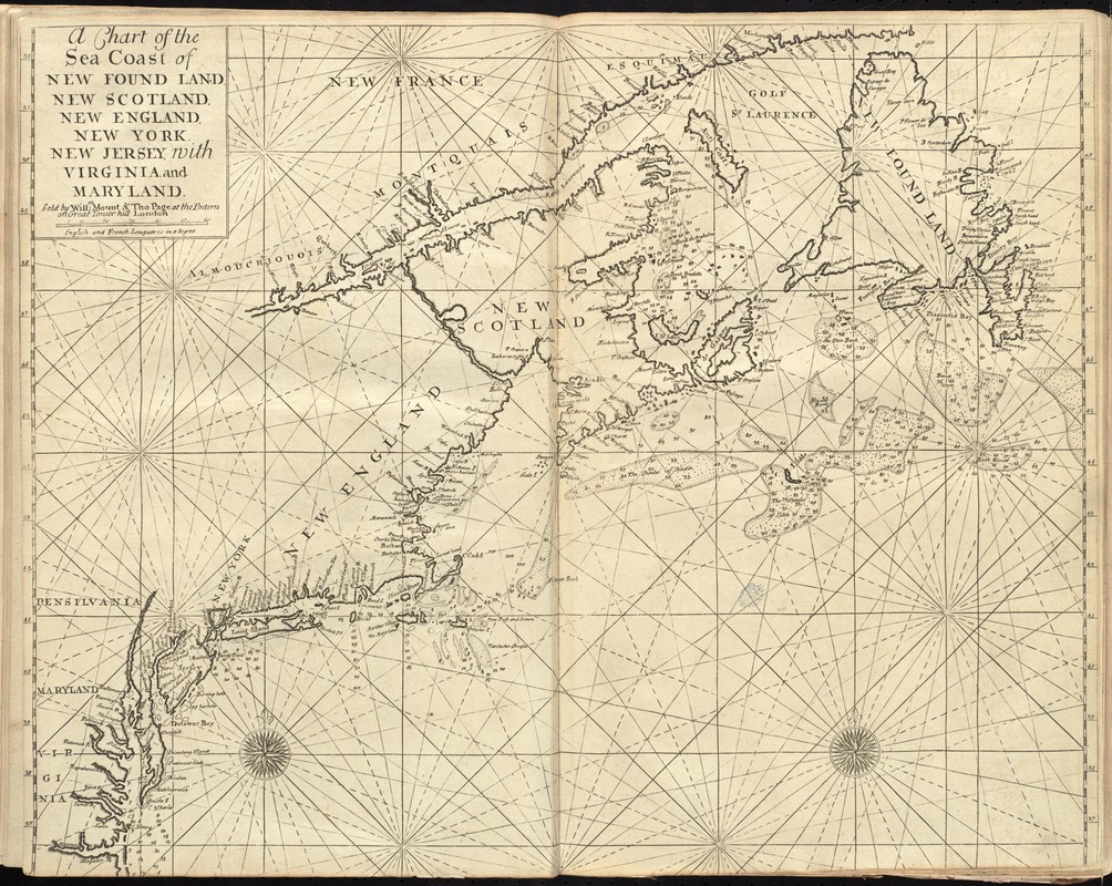
A chart of the sea coast of New Found Land, New Scotland, New England, New York, New Jersey, with Virginia and Maryland
Item Information
- Title:
- A chart of the sea coast of New Found Land, New Scotland, New England, New York, New Jersey, with Virginia and Maryland
- Creator:
- W. Mount and T. Page
- Bookseller:
- Page, Thomas, d. 1733
- Bookseller:
- Mount, William, d. 1769
- Date:
-
[1737]
- Format:
-
Maps/Atlases
- Location:
-
Boston Public Library
Norman B. Leventhal Map Center - Collection (local):
-
Norman B. Leventhal Map Center Collection
- Subjects:
-
Coasts--Canada, Eastern--Maps--Early works to 1800
Coasts--Middle Atlantic States--Maps--Early works to 1800
Coasts--New England--Maps--Early works to 1800
Nautical charts--Atlantic Coast (North America)--Early works to 1800
Atlantic Coast (North America)--Maps--Early works to 1800
- Places:
-
North America (area)
New England (area)
Middle Atlantic (area)
Canada
- Extent:
- 1 map ; 45 x 56 cm.
- Terms of Use:
-
No known copyright restrictions.
No known restrictions on use.
- Publisher:
-
London :
Sold by Willm. Mount & Tho. Page at the Postern on Great Tower Hill
- Scale:
-
Scale [ca. 1:3,600,000]
- Language:
-
English
- Notes:
-
Depth shown by soundings.
Second state.
In the English pilot, the fourth book. London : Printed for William Mount and Thomas Page, 1737.
- Notes (date):
-
This date is inferred.
- Identifier:
-
06_01_010259
- Call #:
-
G1106.P5 .E54 1737
- Barcode:
-
30000003246685