A correct map of the coast of New England
Item Information
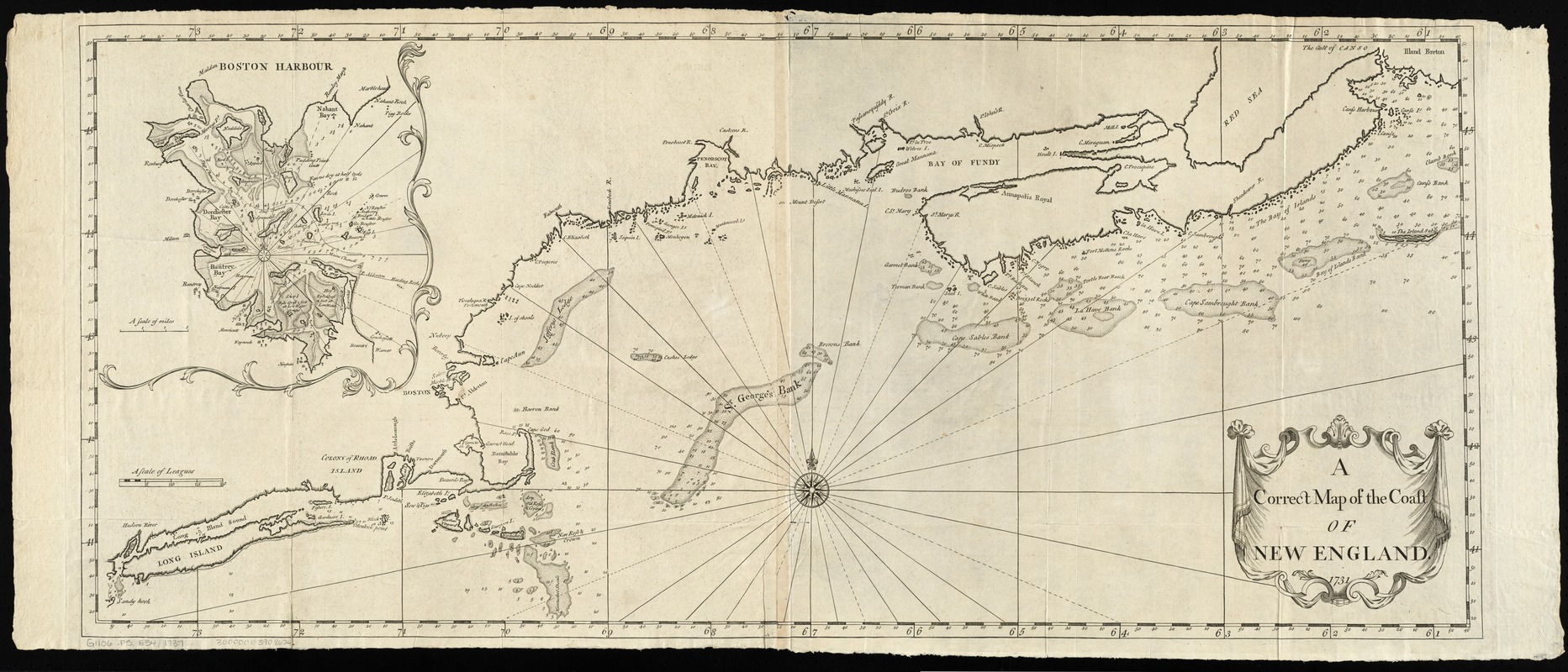
- Title:
- A correct map of the coast of New England
- Creator:
- Southack, Cyprian, 1662-1745
- Date:
-
[1737]
- Format:
-
Maps/Atlases
- Location:
-
Boston Public Library
Norman B. Leventhal Map Center - Collection (local):
-
Norman B. Leventhal Map Center Collection
- Subjects:
-
Nautical charts--New England--Early works to 1800
Coasts--New England--Maps--Early works to 1800
New England--Maps--Early works to 1800
Atlantic Coast (New England)--Maps--Early works to 1800
- Places:
-
New England (area)
- Extent:
- 1 map ; 45 x 105 cm.
- Terms of Use:
-
No known copyright restrictions.
No known restrictions on use.
- Publisher:
-
London :
Printed for William Mount and Thomas Page
- Scale:
-
Scale [ca. 1:1,230,000]
- Language:
-
English
- Notes:
-
Depth shown by soundings.
Plate 13 from the English pilot, fourth book (Mount and Page, 1737).
Inset: Boston Harbour.
- Notes (date):
-
This date is inferred.
- Identifier:
-
06_01_009910
- Call #:
-
G1105.P5 E54 1737
- Barcode:
-
30000003908624

![[Coast of New England from Chatham Harbor to Naragansett Bay]](https://bpldcassets.blob.core.windows.net/derivatives/images/commonwealth:7h149x27g/image_thumbnail_300.jpg)
![[Coast of New England from Chatham Harbor to Naragansett Bay]](https://bpldcassets.blob.core.windows.net/derivatives/images/commonwealth:7h149z37x/image_thumbnail_300.jpg)

