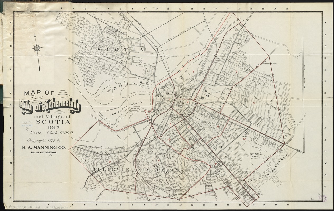
Map of city of Schenectady and village of Scotia, 1917
Item Information
- Title:
- Map of city of Schenectady and village of Scotia, 1917
- Title (alt.):
-
Schenectady street directory, 1919
Street directory and map of Schenectady New York
Street directory and map of Schenectady, New York
- Creator:
- H.A. Manning Company
- Date:
-
1919
- Format:
-
Maps/Atlases
- Location:
-
Boston Public Library
Norman B. Leventhal Map Center - Collection (local):
-
Norman B. Leventhal Map Center Collection
- Subjects:
-
Schenectady (N.Y.)--Maps
Schenectady (N.Y.)--Administrative and political divisions--Maps
Scotia (N.Y.)--Maps
- Places:
-
Schenectady (county)Schenectady
Schenectady (county)Scotia
- Extent:
- 1 map : col. ; 43 x 66 cm., folded in cover 16 x 11 cm. + 1 booklet (15 p. ; 16 cm.)
- Terms of Use:
-
No known copyright restrictions.
No known restrictions on use.
- Publisher:
-
[Schenectady, N.Y.] :
H.A. Manning Co.
- Scale:
-
Scale [1:14,400]
- Language:
-
English
- Notes:
-
Copyright 1917 by H.A. Manning Co. for the city directory.
Oriented with north to the upper left.
Issued with Street directory and map of Schenectady, New York.-- Schenectady, N.Y. : H.A. Manning Co., c1919.
- Identifier:
-
06_01_009892
- Call #:
-
G3804.S4 1917 .H13
- Barcode:
-
39999065664615