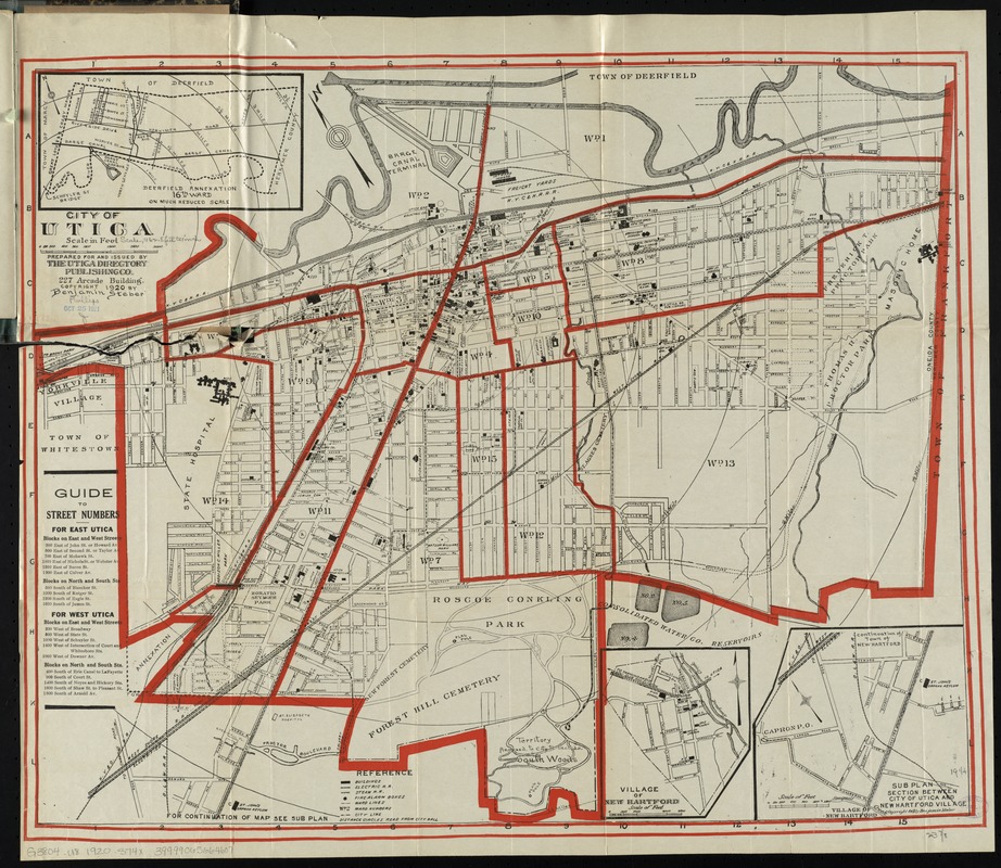
City of Utica
Item Information
- Title:
- City of Utica
- Title (alt.):
-
Map. street directory, and guide of Utica
- Creator:
- Steber, Benjamin.
- Name on Item:
-
/ prepared for and issued by The Utica Directory Publishing Co.
- Date:
-
1920
- Format:
-
Maps/Atlases
- Location:
-
Boston Public Library
Norman B. Leventhal Map Center - Collection (local):
-
Norman B. Leventhal Map Center Collection
- Subjects:
-
Utica (N.Y.)--Maps
- Places:
-
Oneida (county)Utica
- Extent:
- 1 map : col. ; 49 x 60 cm.
- Terms of Use:
-
No known copyright restrictions.
No known restrictions on use.
- Publisher:
-
[Utica] :
Benjamin Steber
- Scale:
-
Scale [ca. 1:12,300]
- Language:
-
English
- Notes:
-
Shows buildings, railroads, wards, and radial distances from City Hall.
Oriented with north toward the upper left.
Insets: Deerfield annexation, 16th ward -- Village of New Hartford -- Subplan section between city of Utica and New Hartford Village.
Includes guide to street numbers.
Accompanied by street directory (48 p. ; 20 cm.)
- Identifier:
-
06_01_009891
- Call #:
-
G3804.U8 1920 .S74x
- Barcode:
-
39999065664607


