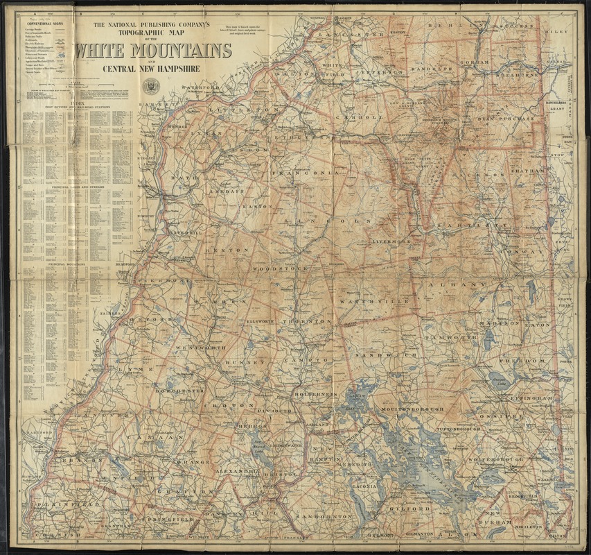
The National Publishing Company's topographic map of the White Mountains and central New Hampshire
Item Information
- Title:
- The National Publishing Company's topographic map of the White Mountains and central New Hampshire
- Title (alt.):
-
Topographic map of the White Mountains and central New Hampshire
- Creator:
- National Publishing Company (Boston, Mass.)
- Date:
-
[ca. 1902]
- Format:
-
Maps/Atlases
- Location:
-
Boston Public Library
Norman B. Leventhal Map Center - Collection (local):
-
Norman B. Leventhal Map Center Collection
- Subjects:
-
White Mountains (N.H. and Me.)--Maps
New Hampshire--Maps
- Places:
-
White Mountains
- Extent:
- 1 map : col. ; 90 x 95 cm.
- Terms of Use:
-
No known copyright restrictions.
No known restrictions on use.
- Publisher:
-
Boston :
The Company
- Scale:
-
Scale [1:126,720]. 2 miles to an in.
- Language:
-
English
- Notes:
-
This map is based upon the latest U.S. Gov't, state and private surveys and original field work.
Relief shown by contours and spot heights.
Includes index to post offices and railroad stations, principal lakes and streams, and principal mountains.
- Identifier:
-
06_01_009820
- Call #:
-
G3742.W52C2 1902 .N38
- Barcode:
-
39999065709337