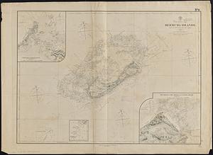
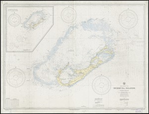
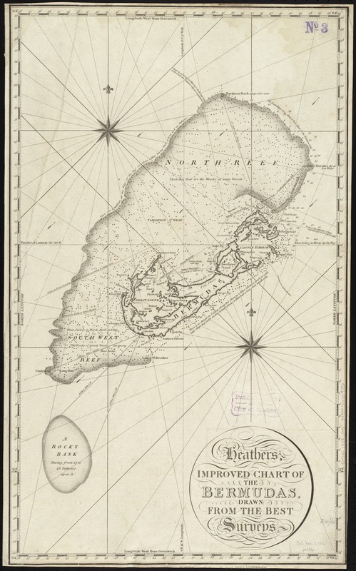
Heathers, improved chart of the Bermudas, drawn from the best surveys
Item Information
- Title:
- Heathers, improved chart of the Bermudas, drawn from the best surveys
- Creator:
- Heather, William, 1764-1812
- Name on Item:
-
Stevenson, engraver.
- Date:
-
1805
- Format:
-
Maps/Atlases
- Location:
-
Boston Public Library
Norman B. Leventhal Map Center - Collection (local):
-
Norman B. Leventhal Map Center Collection
- Subjects:
-
Nautical charts--Bermuda Islands
Bermuda Islands--Maps
- Places:
-
Bermuda (territory)
- Extent:
- 1 map ; 62 x 37 cm.
- Terms of Use:
-
No known copyright restrictions.
No known restrictions on use.
- Publisher:
-
London :
William Heather
- Scale:
-
Scale [ca. 1:141,000]
- Language:
-
English
- Notes:
-
Depth shown by shading and soundings.
Cataloging, conservation, and digitization made possible in part by The National Endowment for the Humanities: Exploring the human endeavor.
- Identifier:
-
06_01_009765
- Call #:
-
G9120 1805 .H43
- Barcode:
-
39999065709782