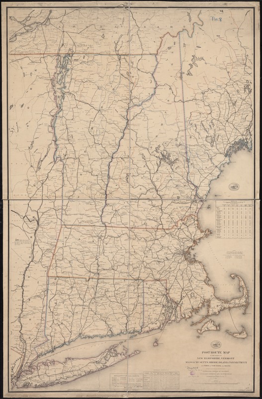
Post route map of the states of New Hampshire, Vermont, Massachusetts, Rhode Island, Connecticut, and parts of New York and Maine
Item Information
- Title:
- Post route map of the states of New Hampshire, Vermont, Massachusetts, Rhode Island, Connecticut, and parts of New York and Maine
- Creator:
- Nicholson, W. L.
- Name on Item:
-
designed and constructed under the orders of Postmaster General Wm. Dennison and Second Ass't Postmaster Gen'l Geo. Wm. McLellan, by W.L. Nicholson topographer of P.O. Dept. ; draughtsman P. Goepel ; eng. by D. McClelland.
- Date:
-
1866
- Format:
-
Maps/Atlases
- Location:
-
Boston Public Library
Norman B. Leventhal Map Center - Collection (local):
-
Norman B. Leventhal Map Center Collection
- Subjects:
-
Postal service--New England--Maps
Railroads--New England--Maps
New England--Maps
- Places:
-
New England (area)
- Extent:
- 1 map : col. ; 150 x 94 cm.
- Terms of Use:
-
No known copyright restrictions.
No known restrictions on use.
- Publisher:
-
Washington :
[Post Office Dept.]
- Scale:
-
Scale [1:380,160]. 6 mi. = 1 in.
- Language:
-
English
- Notes:
-
Prime meridian: Washington, D.C.
Includes a table of distances and a table of general statistics.
Shows towns and major roads with emphasis on railroads.
"The service on this diagram brought up to date of March 1st. 1868." Decr. 29th. 1866 printed below and crossed out.
- Identifier:
-
06_01_009759
- Call #:
-
G3721.P8 1866 .U551
- Barcode:
-
39999065663054


