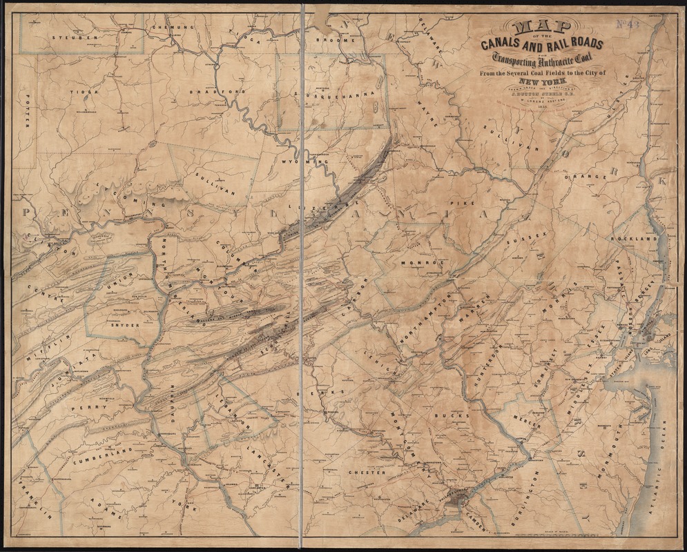
Map of the canals and rail roads for transporting anthracite coal from the several coal fields to the city of New York
Item Information
- Title:
- Map of the canals and rail roads for transporting anthracite coal from the several coal fields to the city of New York
- Creator:
- Lorenz, William, 1826-1884
- Name on Item:
-
drawn under the direction of J. Dutton Steele, C.E., by W. Lorenz, Asst. Eng.
- Date:
-
1856
- Format:
-
Maps/Atlases
- Location:
-
Boston Public Library
Norman B. Leventhal Map Center - Collection (local):
-
Norman B. Leventhal Map Center Collection
- Subjects:
-
Coal--Transportation--Pennsylvania--Maps
Coal--Transportation--New Jersey--Maps
Coal--Transportation--New York (State)--Maps
Coal mines and mining--Pennsylvania--Maps
Coalfields--Pennsylvania--Maps
Pennsylvania--Maps
New Jersey--Maps
New York (State)--Maps
- Places:
-
Pennsylvania
New York
New Jersey
- Extent:
- 1 map : col. ; 83 x 105 cm.
- Terms of Use:
-
No known copyright restrictions.
No known restrictions on use.
- Publisher:
-
Baltimore :
Lith. on one stone and printed in colors by Hunckel & Son
- Scale:
-
Scale [ca. 1:322,000]
- Language:
-
English
- Notes:
-
Relief shown by hachures.
Shows eastern Pennsylvania and parts of New York and Delaware.
- Identifier:
-
06_01_009758
- Call #:
-
G3821.H9 1856 .L67
- Barcode:
-
39999065663047


