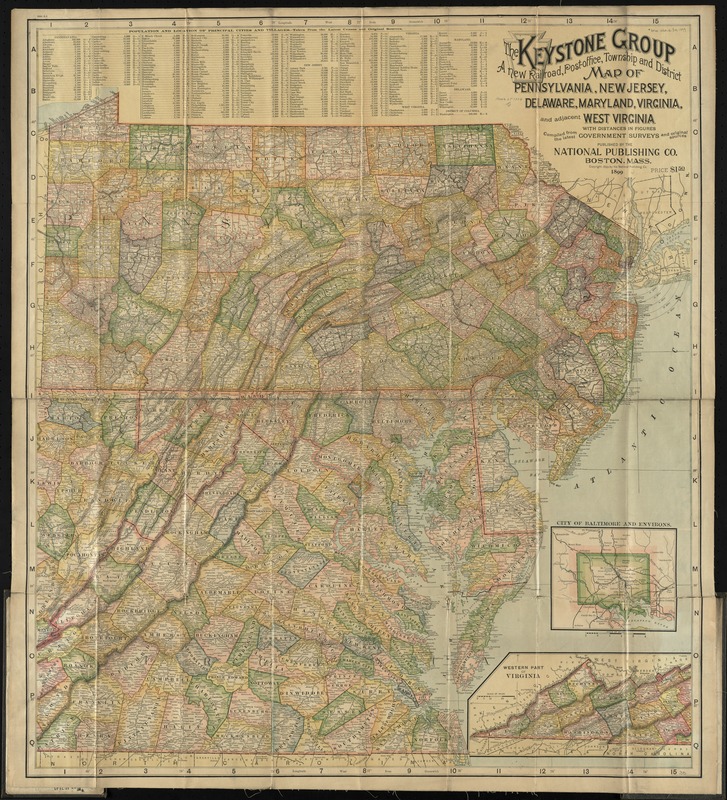
The Keystone group : a new railroad, post-office, township and district map of Pennsylvania, New Jersey, Delaware, Maryland, Virginia, and adjacent West Virginia, with distances in figures
Item Information
- Title:
- The Keystone group : a new railroad, post-office, township and district map of Pennsylvania, New Jersey, Delaware, Maryland, Virginia, and adjacent West Virginia, with distances in figures
- Creator:
- National Publishing Company (Boston, Mass.)
- Date:
-
[ca. 1899]
- Format:
-
Maps/Atlases
- Location:
-
Boston Public Library
Norman B. Leventhal Map Center - Collection (local):
-
Norman B. Leventhal Map Center Collection
- Subjects:
-
Railroads--Middle Atlantic States--Maps
Railroads--Virginia--Maps
Middle Atlantic States--Maps
Virginia--Maps
- Places:
-
Virginia
Middle Atlantic (area)
- Extent:
- 1 map : col. ; 86 x 76 cm.
- Terms of Use:
-
No known copyright restrictions.
No known restrictions on use.
- Publisher:
-
Boston :
The Company
- Scale:
-
Scale [ca. 1:832,000]
- Language:
-
English
- Notes:
-
Relief shown by hachures.
Insets: City of Baltimore and environs -- Western part of Virginia.
Includes index with population figures.
- Identifier:
-
06_01_009745
- Call #:
-
G3790 1899 .N38
- Barcode:
-
39999065663120


