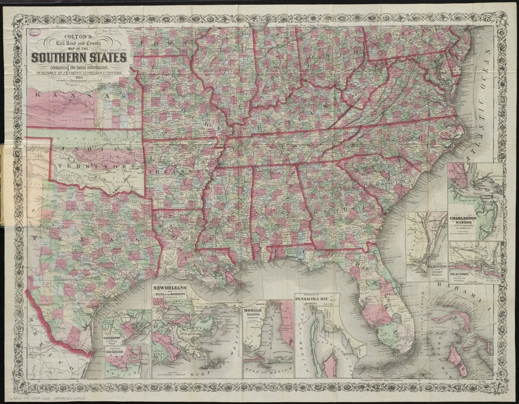
Colton's rail road and county map of the Southern States containing the latest information
Item Information
- Title:
- Colton's rail road and county map of the Southern States containing the latest information
- Title (alt.):
-
Colton's map of the southern states, showing the counties & railroads, cities, towns, railroad stations &c
- Creator:
- Colton, J. H. (Joseph Hutchins), 1800-1893
- Date:
-
1864
- Format:
-
Maps/Atlases
- Location:
-
Boston Public Library
Norman B. Leventhal Map Center - Collection (local):
-
Norman B. Leventhal Map Center Collection
- Subjects:
-
Railroads--Southern States--Maps
Counties--Southern States--Maps
Southern States--Maps
- Places:
-
Southern United States (area)
- Extent:
- 1 map : hand col. ; 61 x 79 cm., folded in cover 15 x 10 cm.
- Terms of Use:
-
No known copyright restrictions.
No known restrictions on use.
- Publisher:
-
New York :
J.H. Colton
- Scale:
-
Scale [1:3,041,280]. 48 miles = 1 in.
- Language:
-
English
- Notes:
-
Relief shown by hachures.
Insets: Galveston and vicinity, Texas -- Vicinity of the Rio Grande -- New Orleans and delta of the Mississippi, Louisiana -- Mobile harbor, Alabama -- Entrance to Pensacola Bay, Florida -- Wilmington and vicinity, N. Carolina -- Charleston harbor and its approaches, S. Carolina -- Beaufort and vicinity, N. Carolina.
- Identifier:
-
06_01_009800
- Call #:
-
G3861.P3 1864 .C65
- Barcode:
-
39999065709428
- LCCN:
-
2006628388


