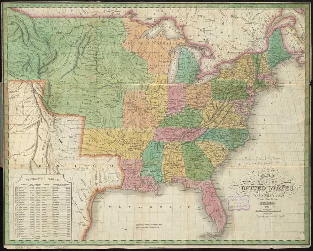
Map of the United States, constructed from the latest authorities
Item Information
- Title:
- Map of the United States, constructed from the latest authorities
- Creator:
- Finley, A. (Anthony)
- Name on Item:
-
J.H. Young, sc.
- Date:
-
1827
- Format:
-
Maps/Atlases
- Location:
-
Boston Public Library
Norman B. Leventhal Map Center - Collection (local):
-
Norman B. Leventhal Map Center Collection
- Subjects:
-
United States--Maps
- Places:
-
- Extent:
- 1 map : hand col. ; 42 x 52 cm., folded in cover 15 x 10 cm.
- Terms of Use:
-
No known copyright restrictions.
No known restrictions on use.
- Publisher:
-
Philad[elphi]a :
Published by A. Finley
- Scale:
-
Scale [ca. 1:7,200,000]
- Language:
-
English
- Notes:
-
Relief shown pictorially.
Prime meridians: Washington and Greenwich.
Includes statistical table listing states with areas, populations, capitals, and populations of principal cities and towns.
"The publisher is indebted to the politeness of Major S.H. Long for the use of his documents in the construction of that portion of this map west of the Mississippi River."
- Identifier:
-
06_01_009836
- Call #:
-
G3700 1827 .F56
- Barcode:
-
39999065709097


