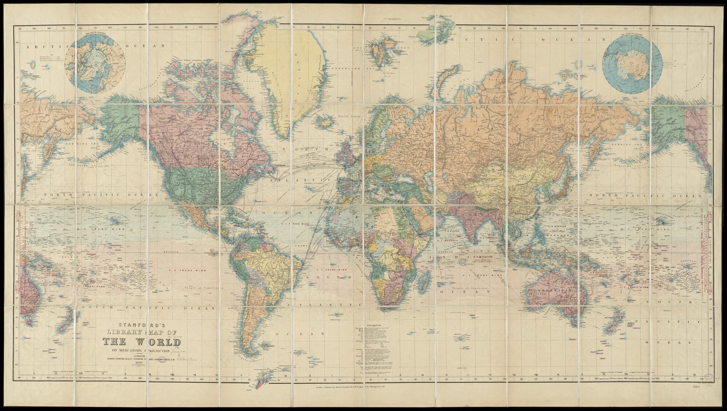
Stanford's library map of the world on Mercator's projection
Item Information
- Title:
- Stanford's library map of the world on Mercator's projection
- Creator:
- Stanford, Edward, 1856-1917
- Name on Item:
-
Stanford's Geogl. Estabt.
- Date:
-
1898
- Format:
-
Maps/Atlases
- Location:
-
Boston Public Library
Norman B. Leventhal Map Center - Collection (local):
-
Norman B. Leventhal Map Center Collection
- Subjects:
-
World maps
- Places:
-
World
- Extent:
- 1 map : col. ; dissected and mounted on linen ; 92 x 167 cm., folded in slipcase 18 x 26 cm.
- Terms of Use:
-
No known copyright restrictions.
No known restrictions on use.
- Publisher:
-
London :
Edward Stanford
- Scale:
-
Scale [ca. 1:31,000,000] at equator ;
- Language:
-
English
- Notes:
-
Shows ocean currents, tradewinds, vertical action of the sun, principal ocean mail routes and submarine telegraph cables.
Relief shown by hachures.
Insets: The Arctic regions -- the Antarctic regions.
- Identifier:
-
06_01_009695
- Call #:
-
G3200 1898 .S73x
- Barcode:
-
39999065663625


