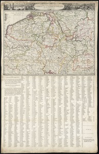
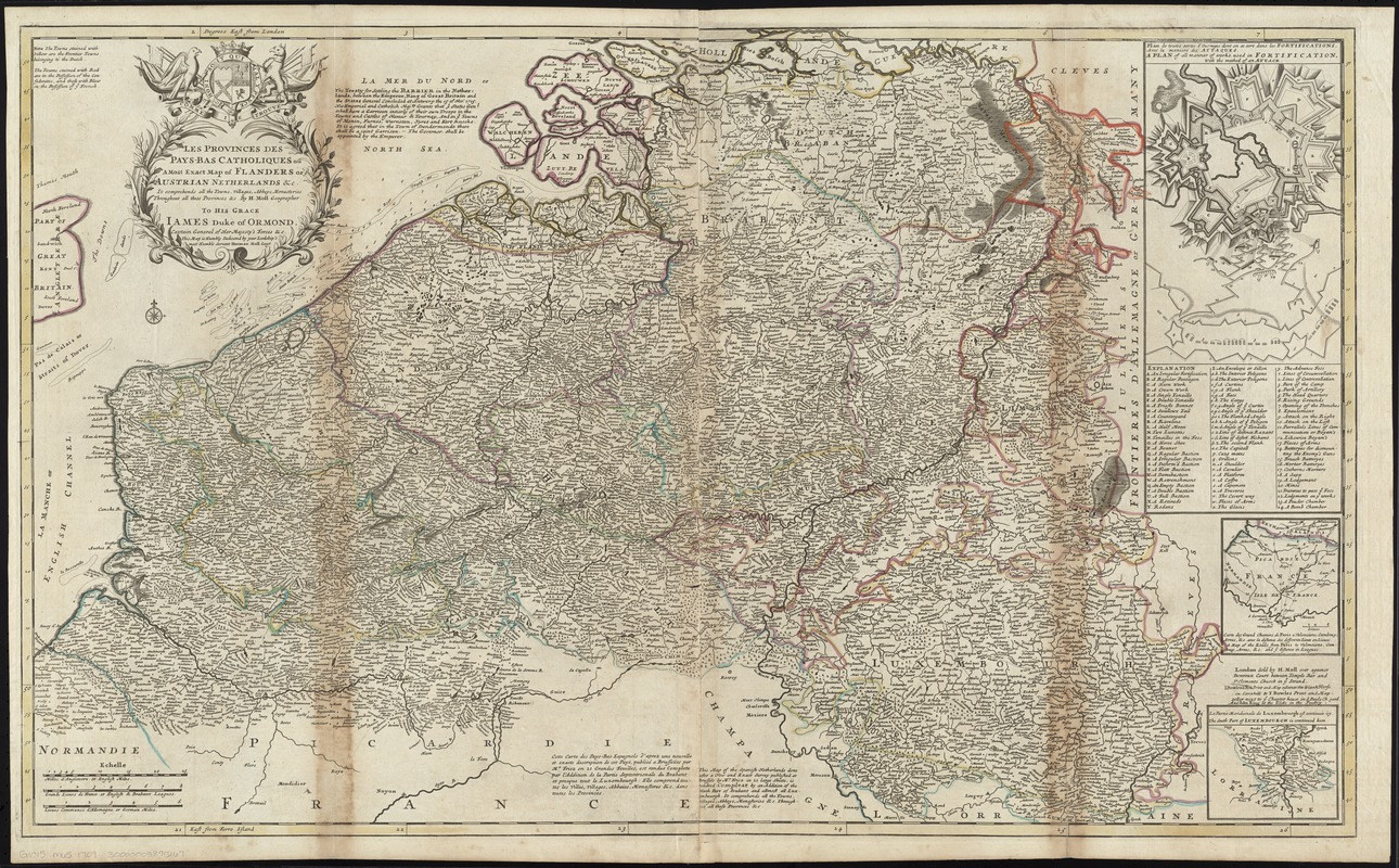
Les provinces des Pays-Bas Catholiques ou A most exact map of Flanders or ye Austrian Netherlands &c : it comprehends all the towns, villages, abbeys, monasteries throughout all these provinces &c
Item Information
- Title:
- Les provinces des Pays-Bas Catholiques ou A most exact map of Flanders or ye Austrian Netherlands &c : it comprehends all the towns, villages, abbeys, monasteries throughout all these provinces &c
- Title (alt.):
-
Most exact map of Flanders or ye Austrian Netherlands &c
- Creator:
- Moll, Herman, d. 1732
- Name on Item:
-
by H. Moll, Geographer.
- Date:
-
[1752–1763]
- Format:
-
Maps/Atlases
- Location:
-
Boston Public Library
Norman B. Leventhal Map Center - Collection (local):
-
Norman B. Leventhal Map Center Collection
- Subjects:
-
Fortification--Designs and plans--Early works to 1800
Military architecture--Designs and plans--Early works to 1800
Military maneuvers--Early works to 1800
Benelux countries--Maps--Early works to 1800
Netherlands--Maps--Early works to 1800
Ormonde, James Butler, Duke of, 1665-1745
- Places:
-
Netherlands
Low Countries (area)
- Extent:
- 1 map : hand col. ; 60 x 99 cm.
- Terms of Use:
-
No known copyright restrictions.
No known restrictions on use.
- Publisher:
-
London :
Sold by H. Moll .... I. Bowles & Son ... & T. Bowles .... And John King
- Scale:
-
Scale [ca. 1:425,000]
- Language:
-
English
French
- Notes:
-
Relief shown pictorially and by soundings.
Prime meridians: London and Ferro.
Towns colored to indicate French, Dutch and Flemish possession.
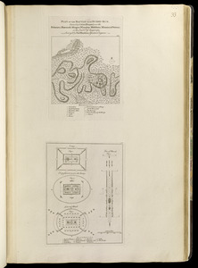
Insets: Plan du toutes sortes d'ouvrages dont on se sert dans les fortifications, avec la maniere des attaques = A plan of all manner of works used in fortification, with the method of an attack -- Carte des Grand Chemins de Paris a Valenciene, Cambray, Arras, &c. avec la distance des differents lieux en lieues = A map of the roads from Paris to Valenciene, Cambray, Arras, &c. and ye distances in leagues -- La partie meridionale de Luxembourgh est continuée icy = The south part of Luxembourgh is continued here.
Dedication: To His Grace Iames Duke of Ormond, Captain General of Her Majesty's Forces &c. This map is humbly dedicated by your Lordship's most humble servant Herman Moll Geogr.
Appears in Moll's The world described, [1709-1736], plate 24.
In English and French.
- Notes (date):
-
This date is inferred.
- Identifier:
-
06_01_009685
- Call #:
-
G1015 .M65 1709
- Barcode:
-
30000003895167