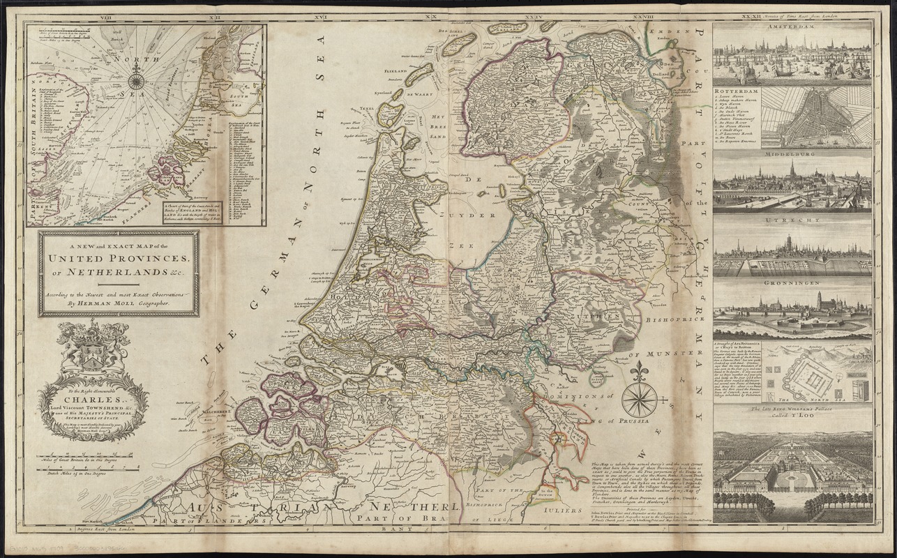
A new and exact map of the United Provinces, or Netherlands &c
Item Information
- Title:
- A new and exact map of the United Provinces, or Netherlands &c
- Creator:
- Moll, Herman, d. 1732
- Name on Item:
-
according to the newest and most exact observations by Herman Moll geographer.
- Date:
-
[1710?–1719?]
- Format:
-
Maps/Atlases
- Location:
-
Boston Public Library
Norman B. Leventhal Map Center - Collection (local):
-
Norman B. Leventhal Map Center Collection
- Subjects:
-
Netherlands--Maps--Early works to 1800
- Places:
-
Netherlands
- Extent:
- 1 map : hand col. ; 59 x 101 cm.
- Terms of Use:
-
No known copyright restrictions.
No known restrictions on use.
- Publisher:
-
[London] :
Printed for Iohn Bowles ..., T. Bowles ... and by Iohn King
- Scale:
-
Scale [ca. 1:500,000]
- Language:
-
English
- Notes:
-
Relief shown pictorially.
Dedicated to Charles, Lord Viscount Townshend.
Insets: A chart of part of the coastlands and banks of England and Holland &c. -- Amsterdam -- Rotterdam -- Middelburg -- Utrecht -- Gronningen -- A draught of Arx Brittanica or t'Huys te Britten -- The late King William's palace called t'Loo.
Appears in Moll's The world described, [1709-1736], plate 23.
- Identifier:
-
06_01_009686
- Call #:
-
G1015 .M65 1709
- Barcode:
-
30000003895166


