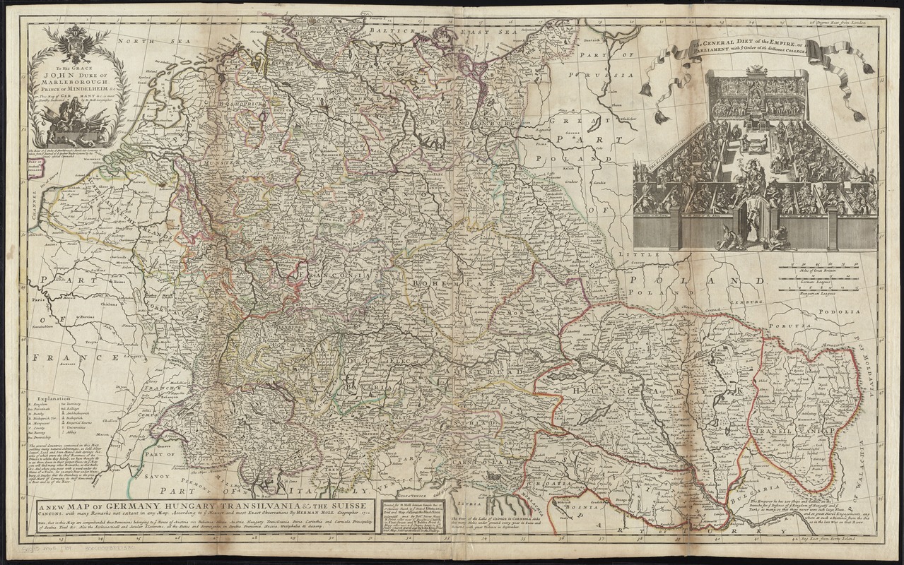
A new map of Germany, Hungary, Transilvania & the Suisse cantons : with many remarks not extant in any map
Item Information
- Title:
- A new map of Germany, Hungary, Transilvania & the Suisse cantons : with many remarks not extant in any map
- Creator:
- Moll, Herman, d. 1732
- Name on Item:
-
according to ye newest and most exact observations, by Herman Moll Geographer, 1712.
- Date:
-
[1750]
- Format:
-
Maps/Atlases
- Location:
-
Boston Public Library
Norman B. Leventhal Map Center - Collection (local):
-
Norman B. Leventhal Map Center Collection
- Subjects:
-
Europe, Central--Maps--Early works to 1800
Marlborough, John Churchill, Duke of, 1650-1722
- Places:
-
Central Europe (area)
- Extent:
- 1 map : hand col. ; 60 x 99 cm.
- Terms of Use:
-
No known copyright restrictions.
No known restrictions on use.
- Publisher:
-
[London] :
Printed for H. Moll ... I. Bowles & Son ... and by Robt. Sayer ... and T. Boules ... and by Iohn King
- Scale:
-
Scale [ca. 1:1,800,000]
- Language:
-
English
- Notes:
-
Relief shown pictorially.
Prime meridians: London and Ferro Island.
Dedication: To His Grace John Duke of Marleborough, Prince of Mindelheim &c. This map of Germany &c. is most Humbly Dedicated by H. Moll Geographer.
Includes notes and ill. of "The general Diet of the empire."
Appears in Moll's The world described, [1709-1736], plate 20.
- Notes (date):
-
This date is inferred.
- Identifier:
-
06_01_009672
- Call #:
-
G1015 .M65 1709
- Barcode:
-
30000003877380
![Carta noua accurata del passagio et strada dalli Paesi Bassi per via de Allemagna per Italia et per via di Paesi Suizeri à Geneua, Lione et Roma per seruizio delli marchanti et viagianti in gen[er]ale ad instanza delli Ss. Scherer et di Momforti speditori delli marchantie in Bregens](https://bpldcassets.blob.core.windows.net/derivatives/images/commonwealth:cj82kw988/image_thumbnail_300.jpg)


