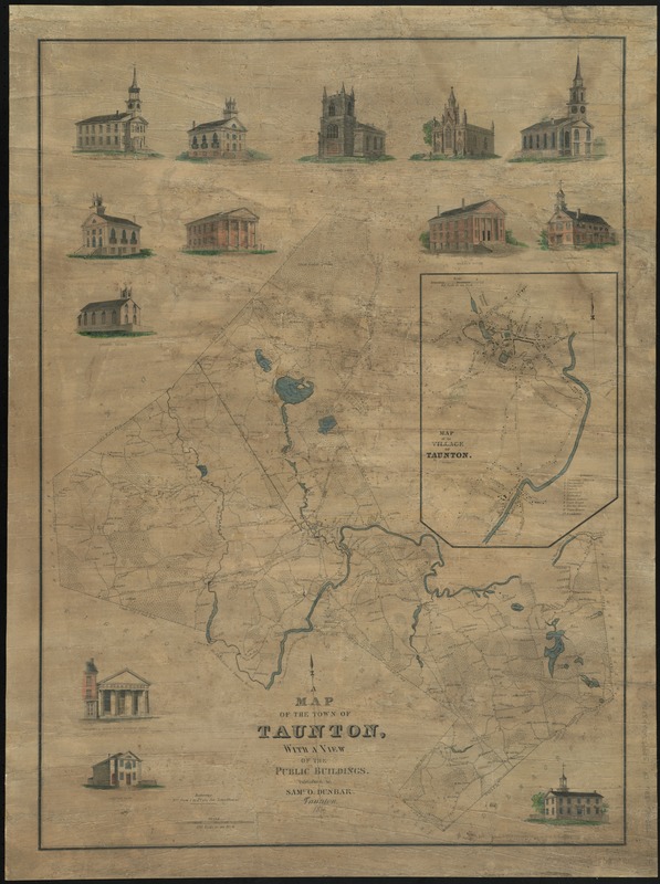
Map of the town of Taunton, with a view of the public buildings
Item Information
- Title:
- Map of the town of Taunton, with a view of the public buildings
- Creator:
- Dunbar, Samuel Oliver, 1800-1883
- Date:
-
1836
- Format:
-
Maps/Atlases
- Location:
-
Boston Public Library
Norman B. Leventhal Map Center - Collection (local):
-
Norman B. Leventhal Map Center Collection
- Series:
- Caldwell Collection of Massachusetts Town Plans
- Subjects:
-
Real property--Massachusetts--Taunton--Maps
Landowners--Massachusetts--Taunton--Maps
Taunton (Mass.)--Maps
- Places:
-
Bristol (county)Taunton
- Extent:
- 1 map : hand col. ; 77 x 56 cm.
- Terms of Use:
-
No known copyright restrictions.
No known restrictions on use.
- Publisher:
-
Taunton, [Mass.] :
Saml. O. Dunbar
- Scale:
-
Scale [1:33,660]. 170 rods to an inch
- Language:
-
English
- Notes:
-
Shows buildings with names of property owners.
Inset: Map of the village of Taunton. Scale [1:7,920].
Includes 13 views of local buildings.
- Identifier:
-
06_01_009638
- Call #:
-
G3764.T2G46 1836 .D8
- Barcode:
-
39999065663856


