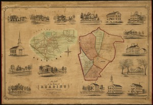
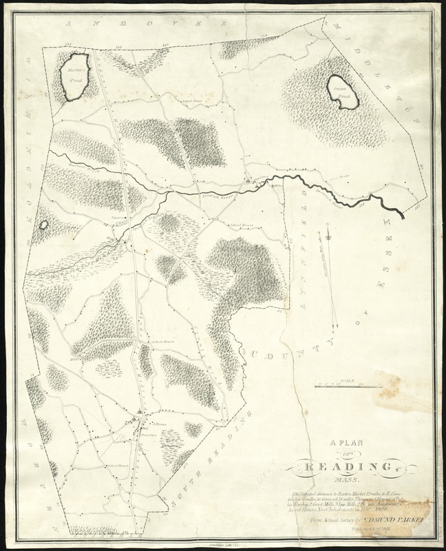
Plan of Reading, Mass
Item Information
- Title:
- Plan of Reading, Mass
- Creator:
- Parker, Edmund.
- Name on Item:
-
from actual survey by Edmund Parker.
- Date:
-
1831
- Format:
-
Maps/Atlases
- Location:
-
Boston Public Library
Norman B. Leventhal Map Center - Collection (local):
-
Norman B. Leventhal Map Center Collection
- Series:
- Caldwell Collection of Massachusetts Town Plans
- Subjects:
-
Reading (Mass.)--Maps
North Reading (Mass.)--Maps
- Places:
-
Middlesex (county)Reading
Middlesex (county)North Reading
- Extent:
- 1 map ; 58 x 46 cm.
- Terms of Use:
-
No known copyright restrictions.
No known restrictions on use.
- Publisher:
-
[Boston] :
Senefelder Lithc. Co.
- Scale:
-
Scale [ca. 1:19,800]
- Language:
-
English
- Notes:
-
Map depicts the town of Reading, including the area now covering North Reading, showing roads, bodies of water, woodlands, homes, churches, schools, post offices, and taverns.
- Identifier:
-
06_01_009642
- Call #:
-
G3764.R3 1831 .P37
- Barcode:
-
39999065663898