Map of Duxbury, Mass
Item Information
- Title:
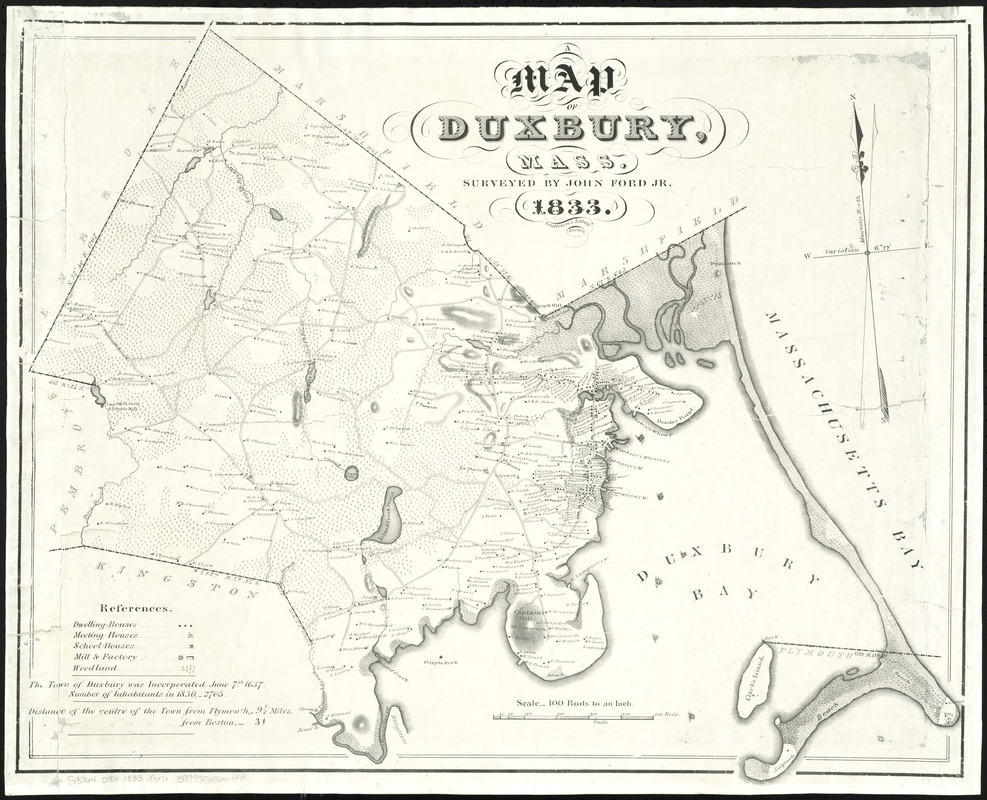
- Map of Duxbury, Mass
- Creator:
- Ford, John, Jr
- Name on Item:
-
surveyed by John Ford, Jr.
- Date:
-
1833
- Format:
-
Maps/Atlases
- Location:
-
Boston Public Library
Norman B. Leventhal Map Center - Collection (local):
-
Norman B. Leventhal Map Center Collection
- Series:
- Caldwell Collection of Massachusetts Town Plans
- Subjects:
-
Real property--Massachusetts--Duxbury--Maps
Landowners--Massachusetts--Duxbury--Maps
Duxbury (Mass.)--Maps
- Places:
-
Plymouth (county)Duxbury
- Extent:
- 1 map : photocopy ; 60 x 74 cm.
- Terms of Use:
-
No known copyright restrictions.
No known restrictions on use.
- Publisher:
-
Boston :
Pendleton's Lithogy
- Scale:
-
Scale [1:19,800]. 100 rods = 1 in.
- Language:
-
English
- Notes:
-
Oriented with north towards the upper left.
Relief shown by shading and hachures.
Shows buildings with names of property owners.
- Identifier:
-
06_01_009636
- Call #:
-
G3764.D84 1833 .F67x
- Barcode:
-
39999065663831