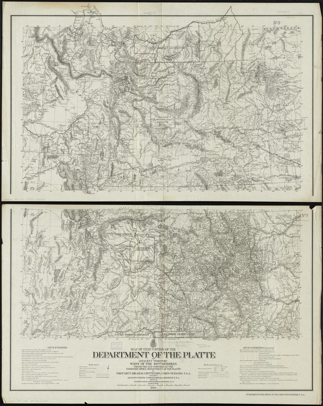
Map of that portion of the Department of the Platte and adjacent territory west of the 103rd meridian
Item Information
- Title:
- Map of that portion of the Department of the Platte and adjacent territory west of the 103rd meridian
- Creator:
- United States. Army. Corps of Engineers
- Name on Item:
-
projected and compiled by Hiram M. Chittenden, assisted by Augustus Smith ; drawn by Augustus Smith.
- Date:
-
1889
- Format:
-
Maps/Atlases
- Location:
-
Boston Public Library
Norman B. Leventhal Map Center - Collection (local):
-
Norman B. Leventhal Map Center Collection
- Subjects:
-
United States. Army. Dept. of the Platte--Maps
Indian reservations--Pacific and Mountain States--Maps
Pacific and Mountain States--Maps
- Places:
-
Mountain Region (area)
Pacific Coast (area)
- Extent:
- 1 map on 2 sheets ; 132 x 106 cm., on sheets 72 x 115 cm.
- Terms of Use:
-
No known copyright restrictions.
No known restrictions on use.
- Publisher:
-
[Washington, D.C.] :
Office of the Chief of Engineers
- Scale:
-
Scale [ca. 1:1,000,000]
- Language:
-
English
- Notes:
-
Covers Idaho, Wyoming, Utah, and Colorado.
Prime meridians: Washington and Greenwich.
Relief shown by hachures and spot heights.
Also shows indian reservations.
Includes list of authorities.
- Identifier:
-
06_01_009270
- Call #:
-
G4220 1889 .U55
- Barcode:
-
39999065660027