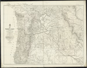
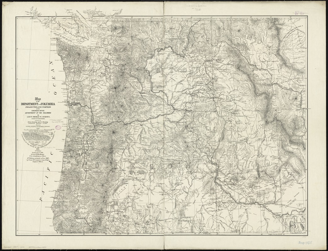
Map of the Department of the Columbia
Item Information
- Title:
- Map of the Department of the Columbia
- Creator:
- United States. Army. Dept. of the Columbia
- Name on Item:
-
projected and compiled at the Engineer Office, Department of the Columbia, by Thomas W. Symons ; assisted by Alfred Downing and C.C. Manning ; drawn by Alfred Downing.
- Date:
-
1887
- Format:
-
Maps/Atlases
- Location:
-
Boston Public Library
Norman B. Leventhal Map Center - Collection (local):
-
Norman B. Leventhal Map Center Collection
- Subjects:
-
Northwest, Pacific--Maps
- Places:
-
Northwestern United States (area)
- Extent:
- 1 map ; 81 x 102 cm.
- Terms of Use:
-
No known copyright restrictions.
No known restrictions on use.
- Publisher:
-
[Washington, D.C.] :
Office of the Chief of Engineers, U.S. Army
- Edition:
- 3rd ed., rev. to Dec. 1887 /
- Scale:
-
Scale [ca. 1:1,000,000]
- Language:
-
English
- Notes:
-
Shows military stations occupied and abandoned as of June 1, 1885, railroads existing and projected, wagon roads, and lighthouses.
Relief shown by hachures and spot heights.
Includes list of sources consulted in compilation.
Includes 1st and 2nd edition statements.
- Identifier:
-
06_01_009251
- Call #:
-
G4240 1887 .U55
- Barcode:
-
39999065660290