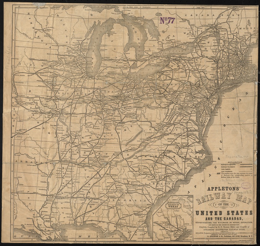
Appletons' railway map of the United States and the Canadas : representing railways in actual operation, and those in the course of construction
Item Information
- Title:
- Appletons' railway map of the United States and the Canadas : representing railways in actual operation, and those in the course of construction
- Title (alt.):
-
Railway map of the United States and the Canadas
- Creator:
- Thomas, G. F.
- Name on Item:
-
carefully compiled by G. F. Thomas ; Fisk & Russell engrs.
- Date:
-
1869
- Format:
-
Maps/Atlases
- Location:
-
Boston Public Library
Norman B. Leventhal Map Center - Collection (local):
-
Norman B. Leventhal Map Center Collection
- Subjects:
-
Railroads--United States--Maps
United States--Maps
- Places:
-
- Extent:
- 1 map ; 48 x 50 cm.
- Terms of Use:
-
No known copyright restrictions.
No known restrictions on use.
- Publisher:
-
New York :
D. Appleton & Co.
- Scale:
-
Scale [ca. 1:4,100,000]
- Language:
-
English
- Notes:
-
Relief shown by hachures.
Prime meridian: Washington, D.C.
Inset: Railways of Texas.
On verso: Text, advertisements, and "Map of Illinois Central Railway and connections."
- Identifier:
-
06_01_009194
- Call #:
-
G3701.P3 1869 .T46x
- Barcode:
-
39999065660852


