Map of the Sunbury and Erie Rail Road and its connections
Item Information
- Title:
- Map of the Sunbury and Erie Rail Road and its connections
- Description:
-
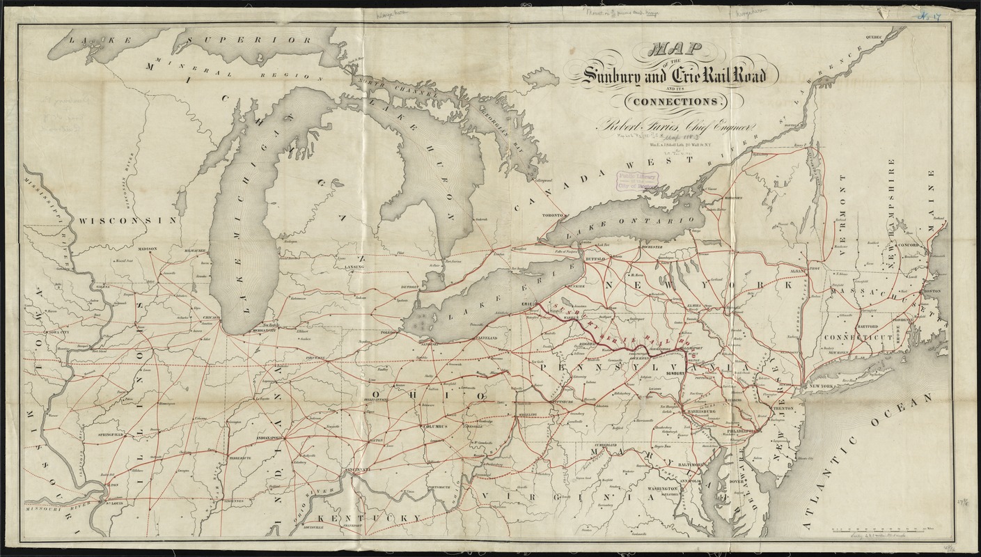
Outline map of the northeastern and north-central United States overprinted in red to show the railroad network. Chartered April 3, 1837. See entry 573.
- Creator:
- Faries, Robert.
- Name on Item:
-
Robert Faries, chief engineer.
- Date:
-
[1850–1859]
- Format:
-
Maps/Atlases
- Location:
-
Boston Public Library
Norman B. Leventhal Map Center - Collection (local):
-
Norman B. Leventhal Map Center Collection
- Subjects:
-
Sunbury and Erie Rail Road Company--Maps
Railroads--Northeastern States--Maps
Northeastern States--Maps
- Places:
-
Northeastern United States (area)
- Extent:
- 1 map : hand col. ; 70 x 126 cm.
- Terms of Use:
-
No known copyright restrictions.
No known restrictions on use.
- Publisher:
-
New York :
Wm. E. & J. Sibell Lith.
- Scale:
-
Scale [ca. 1:1,435,000]
- Language:
-
English
- Notes:
-
Description derived from published bibliography.
- Notes (date):
-
This date is inferred.
- Identifier:
-
06_01_009182
- Call #:
-
G3711.P3 1853 .F35
- Barcode:
-
39999065660738
- LCCN:
-
98688814