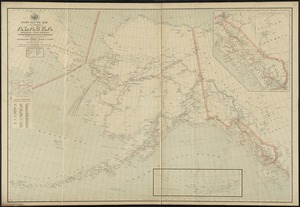
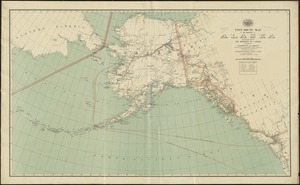
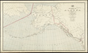
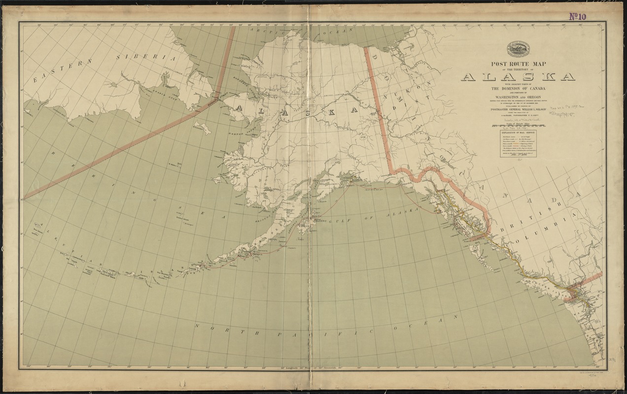
Post route map of the territory of Alaska with adjacent parts of the Dominion of Canada and portions of Washington and Oregon showing post offices with the intermediate distances and mail routes in operation on the 1st of December 1895
Item Information
- Title:
- Post route map of the territory of Alaska with adjacent parts of the Dominion of Canada and portions of Washington and Oregon showing post offices with the intermediate distances and mail routes in operation on the 1st of December 1895
- Creator:
- United States. Post Office Dept
- Name on Item:
-
published by order of Postmaster General William L. Wilson under the direction of A von Haake, topographer P.O. Dept.
- Date:
-
1895
- Format:
-
Maps/Atlases
- Location:
-
Boston Public Library
Norman B. Leventhal Map Center - Collection (local):
-
Norman B. Leventhal Map Center Collection
- Subjects:
-
Postal service--Alaska--Maps
Alaska--Maps
- Places:
-
Alaska
- Extent:
- 1 map : col. ; 65 x 110 cm.
- Terms of Use:
-
No known copyright restrictions.
No known restrictions on use.
- Publisher:
-
[Washington, D.C.] :
Post Office Dept.
- Scale:
-
Scale [ca. 1:4,290,000]
- Language:
-
English
- Notes:
-
Service on this map is brought up to date of Dec. 1st. 1895.
"Service on this map is brought up to date of March 1, 1896."
- Identifier:
-
06_01_009013
- Call #:
-
G4371.P8 1895 .U55x
- Barcode:
-
39999065658120