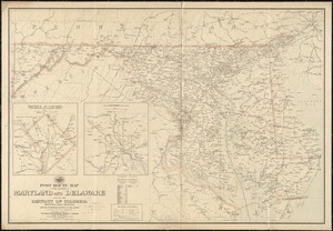
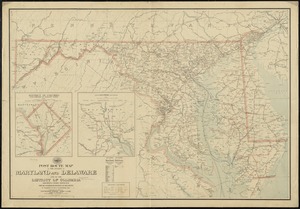
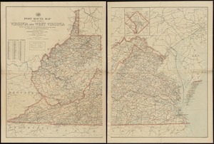
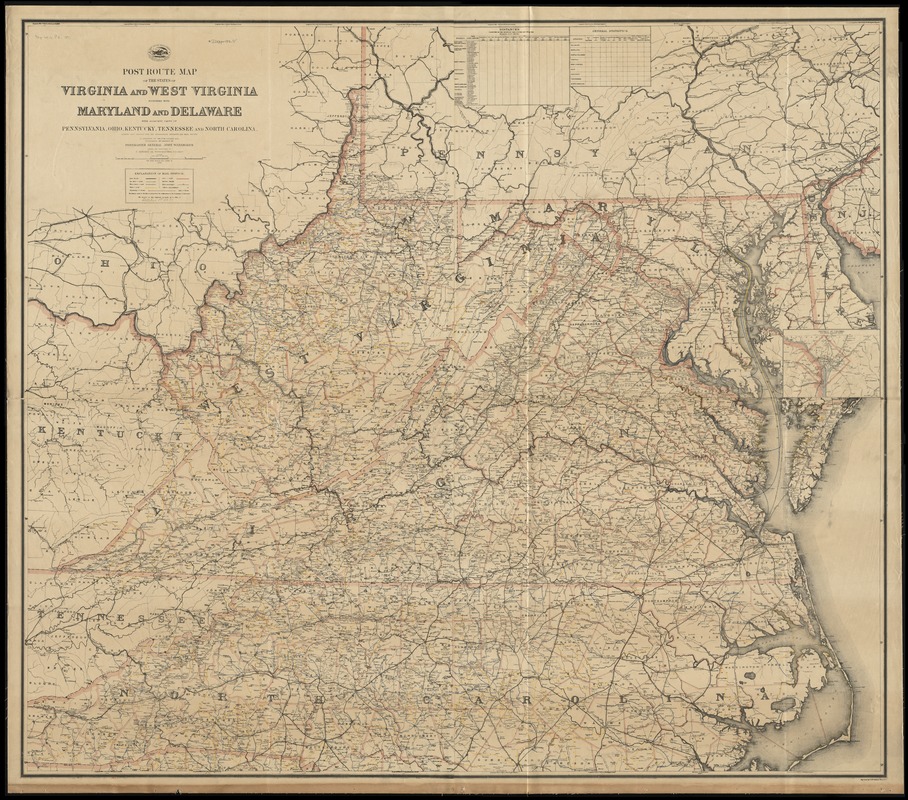
Post route map of the states of Virginia and West Virginia together with Maryland and Delaware with adjacent parts of Pennsylvania, Ohio, Kentucky, Tennessee and North Carolina : showing post offices with the intermediate distances and mail routes in operation on the 1st of October 1891
Item Information
- Title:
- Post route map of the states of Virginia and West Virginia together with Maryland and Delaware with adjacent parts of Pennsylvania, Ohio, Kentucky, Tennessee and North Carolina : showing post offices with the intermediate distances and mail routes in operation on the 1st of October 1891
- Creator:
- United States. Post Office Dept
- Name on Item:
-
published by order of Postmaster General John Wanamaker under the direction of C. Roeser, Jr., topographer, P.O. Dept. ; engraved by D. McClelland.
- Date:
-
1891
- Format:
-
Maps/Atlases
- Location:
-
Boston Public Library
Norman B. Leventhal Map Center - Collection (local):
-
Norman B. Leventhal Map Center Collection
- Subjects:
-
Postal service--Delaware--Maps
Postal service--Maryland--Maps
Postal service--Virginia--Maps
Postal service--West Virginia--Maps
Delaware--Maps
Maryland--Maps
Virginia--Maps
West Virginia--Maps
- Places:
-
Virginia
West Virginia
Maryland
Delaware
- Extent:
- 1 map on 4 sheets : col., assembled ; 136 x 154 cm.
- Terms of Use:
-
No known copyright restrictions.
No known restrictions on use.
- Publisher:
-
[Washington, D.C.] :
The Dept.
- Scale:
-
Scale [1:506,880]. 8 miles to the in.
- Language:
-
English
- Notes:
-
Also shows railroads and counties.
Prime meridian: Washington.
Inset: District of Columbia with portions of adjacent states.
Includes unfilled statistics table and unfilled distance table.
"The service on this diagram brought up to date of October 1st. 1891."
- Identifier:
-
06_01_008992
- Call #:
-
G3881.P8 1891 .U55x
- Barcode:
-
39999065658310