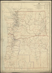
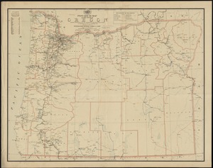
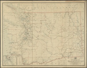
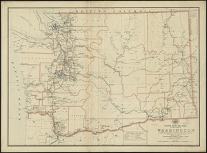
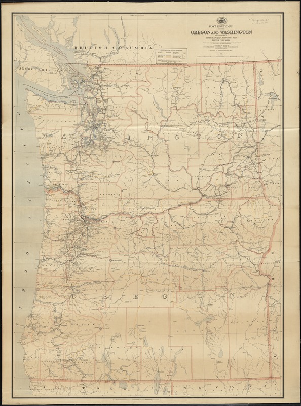
Post route map of the states of Oregon and Washington with adjacent states of Idaho, Nevada, California and British Columbia : showing post offices with the intermediate distances and mail routes in operation on the 1st of October 1891
Item Information
- Title:
- Post route map of the states of Oregon and Washington with adjacent states of Idaho, Nevada, California and British Columbia : showing post offices with the intermediate distances and mail routes in operation on the 1st of October 1891
- Creator:
- United States. Post Office Dept
- Name on Item:
-
published by order of Postmaster General John Wanamaker under the direction of C. Roeser, Jr., topographer, P.O. Dept.
- Date:
-
1891
- Format:
-
Maps/Atlases
- Location:
-
Boston Public Library
Norman B. Leventhal Map Center - Collection (local):
-
Norman B. Leventhal Map Center Collection
- Subjects:
-
Counties--Oregon--Maps
Counties--Washington (State)--Maps
Postal service--Oregon
Postal service--Washington (State)
Railroads--Oregon--Maps
Railroads--Washington (State)--Maps
Oregon--Maps
Washington (State)--Maps
- Places:
-
Oregon
Washington
- Extent:
- 1 map on 2 sheets : col., assembled ; 137 x 96 cm.
- Terms of Use:
-
No known copyright restrictions.
No known restrictions on use.
- Publisher:
-
[Washington, D.C.] :
Post Office Dept.
- Scale:
-
Scale [ca.1:700,000]
- Language:
-
English
- Notes:
-
Also shows railroads and counties.
Relief shown by hachures and spot heights.
Prime meridians: Washington, D. C. and Greenwich.
"The service on this diagram brought up to date of Oct. 1st. 1891."
- Identifier:
-
06_01_009006
- Call #:
-
G4291.P8 1891 .U55x
- Barcode:
-
39999065658245