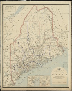
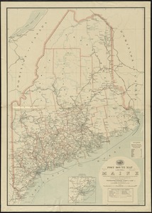
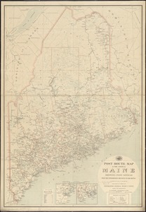
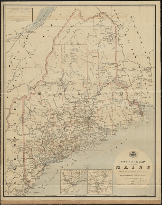
Post route map of the State of Maine showing post offices with the intermediate distances and mail routes in operation on the 1st of October 1891
Item Information
- Title:
- Post route map of the State of Maine showing post offices with the intermediate distances and mail routes in operation on the 1st of October 1891
- Creator:
- United States. Post Office Dept
- Name on Item:
-
published by order of Postmaster General John Wanamaker under the direction of C. Roeser, Jr.
- Date:
-
[1888]
- Format:
-
Maps/Atlases
- Location:
-
Boston Public Library
Norman B. Leventhal Map Center - Collection (local):
-
Norman B. Leventhal Map Center Collection
- Subjects:
-
Counties--Maine--Maps
Postal service--Maine--Maps
Post roads--Maine--Maps
Railway mail service--Maine--Maps
Railroads--Maine--Maps
Maine--Maps
- Places:
-
Maine
- Extent:
- 1 map : col. ; 94 x 74 cm.
- Terms of Use:
-
No known copyright restrictions.
No known restrictions on use.
- Publisher:
-
[Washington, D.C.] :
Post Office Dept.
- Scale:
-
Scale [ca. 1:540,000]
- Language:
-
English
- Notes:
-
Shows counties, railroads, postal routes, delivery schedule, and discontinued post offices.
Prime meridians: Washington, D.C. and Greenwich.
Insets: Environs of Portland -- Environs of Bangor.
"The service on this diagram brought up to date of October 1st. 1891."
- Notes (date):
-
This date is inferred.
- Identifier:
-
06_01_009003
- Call #:
-
G3731.P8 1891 .U55x
- Barcode:
-
39999065658211