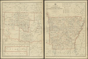
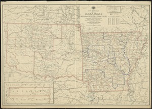
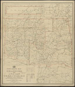
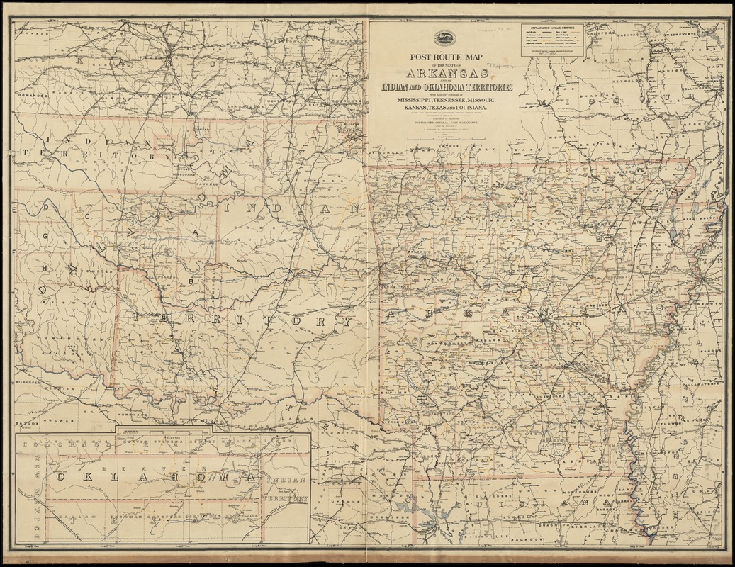
Post route map of the State of Arkansas and of Indian and Oklahoma territories with adjacent portions of Mississippi, Tennessee, Missouri, Kansas, Texas and Louisiana : showing post offices with the intermediate distances and mail routes in operation on the 1st of October 1891
Item Information
- Title:
- Post route map of the State of Arkansas and of Indian and Oklahoma territories with adjacent portions of Mississippi, Tennessee, Missouri, Kansas, Texas and Louisiana : showing post offices with the intermediate distances and mail routes in operation on the 1st of October 1891
- Creator:
- United States. Post Office Dept
- Name on Item:
-
published by order of Postmaster General John Wanamaker under the direction of C. Roeser Jr., topographer, P.O. Dept.
- Date:
-
1891
- Format:
-
Maps/Atlases
- Location:
-
Boston Public Library
Norman B. Leventhal Map Center - Collection (local):
-
Norman B. Leventhal Map Center Collection
- Subjects:
-
Counties--Arkansas--Maps
Counties--Indian Territory--Maps
Counties--Oklahoma--Maps
Postal service--Arkansas--Maps
Postal service--Indian Territory--Maps
Postal service--Oklahoma--Maps
Railroads--Arkansas--Maps
Railroads--Indian Territory--Maps
Railroads--Oklahoma--Maps
Arkansas--Maps
Indian Territory--Maps
Oklahoma--Maps
- Places:
-
Arkansas
Oklahoma
- Extent:
- 1 map on 2 sheets : col., assembled ; 103 x 139 cm.
- Terms of Use:
-
No known copyright restrictions.
No known restrictions on use.
- Publisher:
-
[Washington, D.C.] :
The Dept.
- Scale:
-
Scale [ca. 1:630,000]
- Language:
-
English
- Notes:
-
Also shows counties and railroads.
Prime meridians: Washington and Greenwich.
Inset: [Oklahoma].
"The service on this diagram brought up to date of Oct. 1st 1891."
- Identifier:
-
06_01_008975
- Call #:
-
G4001.P8 1891 .U55x
- Barcode:
-
39999065658435