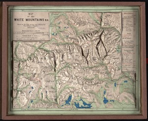
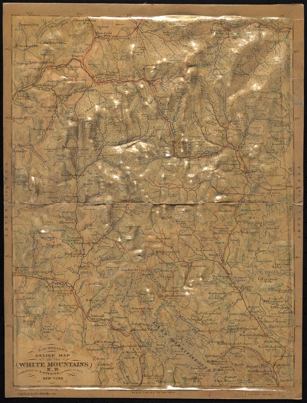
J. Schedler's relief map of the White Mountains, N.H
Item Information
- Title:
- J. Schedler's relief map of the White Mountains, N.H
- Title (alt.):
-
Relief map of the White Mountains, N.H
Schedler's new relief map of the White Mountains
- Creator:
- Schedler, J. (Joseph)
- Date:
-
1879
- Format:
-
Maps/Atlases
- Location:
-
Boston Public Library
Norman B. Leventhal Map Center - Collection (local):
-
Norman B. Leventhal Map Center Collection
- Subjects:
-
White Mountains (N.H. and Me.)--Relief models
- Places:
-
White Mountains
- Extent:
- 1 model : col. ; 31 x 24 x 1 cm., folded in box 27 x 20 cm.
- Terms of Use:
-
No known copyright restrictions.
No known restrictions on use.
- Publisher:
-
New York :
E. Steiger
- Edition:
- Tourist's satchel ed.
- Scale:
-
Scale [1:316,800]. 5 miles to the in.
- Language:
-
English
- Notes:
-
Raised relief model.
Relief also shown by gradient tints and spot heights.
On cover: Compiled and prepared ... by members of the Appalachian Club ; Published by J. Schedler, Jersey City Heights, N.J.
Pressed cardboard relief model sectioned in two, folded in green paper covered cardboard cover.
- Identifier:
-
06_01_010523
- Call #:
-
G3742.W52C18 1879 .S34
- Barcode:
-
39999065709196
- LCCN:
-
2010593231