Diagram of rail roads diverging from Boston : showing the depots and distances
Item Information
- Title:
- Diagram of rail roads diverging from Boston : showing the depots and distances
- Creator:
- Lewis, Alonzo, 1794-1861
- Name on Item:
-
by Alonzo Lewis.
- Date:
-
[1846?]
- Format:
-
Maps/Atlases
- Location:
-
Boston Public Library
Norman B. Leventhal Map Center - Collection (local):
-
Norman B. Leventhal Map Center Collection
- Subjects:
-
Railroads--New England--Maps
Railroads--Connecticut--Maps
Railroads--Massachusetts--Maps
Railroads--Rhode Island--Maps
- Places:
-
Massachusetts
New England (area)
Rhode Island
Connecticut
- Extent:
- 1 map ; 12 x 25 cm.
- Terms of Use:
-
No known copyright restrictions.
No known restrictions on use.
- Publisher:
-
S.l :
s.n.
- Scale:
-
Scale [ca. 1:1,750,000]
- Language:
-
English
- Notes:
-
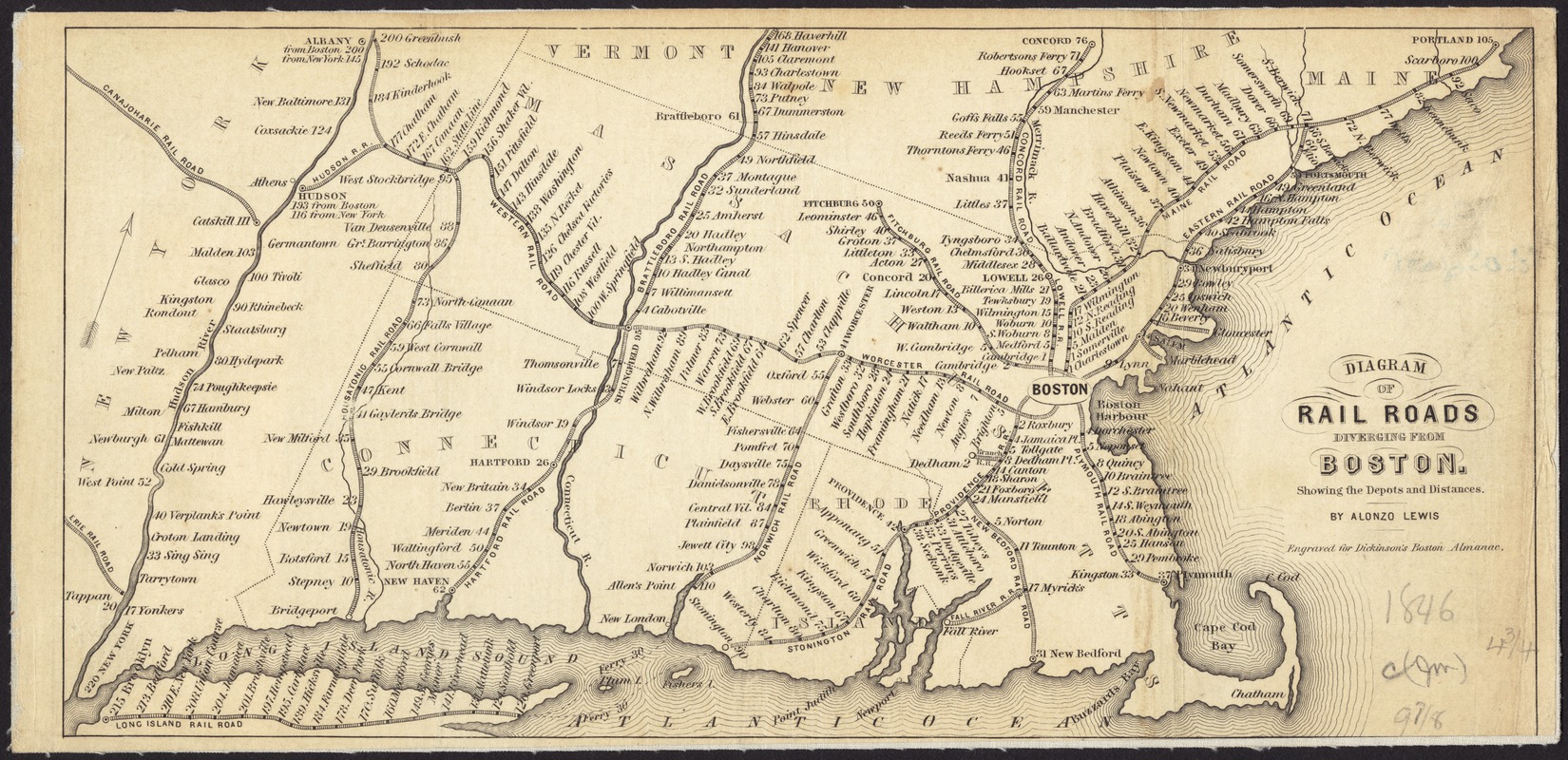
Covers Massachusetts, Connecticut, and Rhode Island, and portions of Maine, New Hampshire, Vermont, and New York.
Shows railroad depots with distances from Boston. Locations of lines and depots stylized and approximate (e.g., Vermont depots shown east of Connecticut River).
Shows Erie, Canajoharie, and Hudson R.R.s (N.Y.); Western R.R. (N.Y. and Mass.); Housatonic, Hartford, and Norwich R.R.s (Conn. and Mass.); Stonington R.R. (Conn. and R.I.); Brattleboro R.R. (Mass., Vt., and N.H.); Providence R.R.(R.I. and Mass.); Worcester, Fitchburg, Lowell, Plymouth, New Bedford, Fall River and Dedham Branch R.R.s (Mass.); Concord R.R. (Mass. and N.H.); and Maine and Eastern R.R.s (Mass., N.H., and Me.).
Oriented with north to the upper right.
"Engraved for Dickinson's Boston Almanac."
- Identifier:
-
06_01_008702
- Call #:
-
G3721.P3 1846 .L49x
- Barcode:
-
39999065656835


