Map of Massachusetts, Rhode-Island & Connecticut : compiled from the latest authorities
Item Information
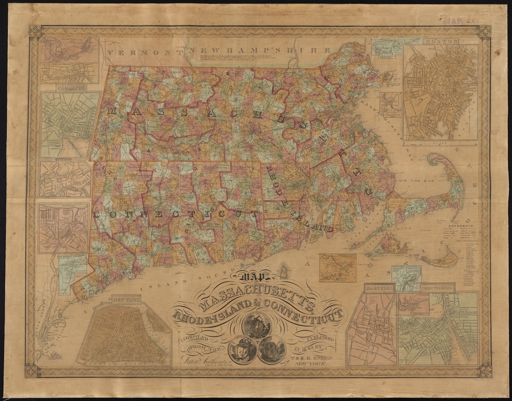
- Title:
- Map of Massachusetts, Rhode-Island & Connecticut : compiled from the latest authorities
- Title (alt.):
-
Map of Massachusetts, Rhode Island and Connecticut
- Creator:
- Wells, J.
- Name on Item:
-
engraved by J. Wells.
- Date:
-
1843
- Format:
-
Maps/Atlases
- Location:
-
Boston Public Library
Norman B. Leventhal Map Center - Collection (local):
-
Norman B. Leventhal Map Center Collection
- Subjects:
-
Factories--Massachusetts--Maps
Factories--Connecticut--Maps
Factories--Rhode Island--Maps
Railroads--Massachusetts--Maps
Railroads--Connecticut--Maps
Railroads--Rhode Island--Maps
Massachusetts--Maps
Connecticut--Maps
Rhode Island--Maps
- Places:
-
Massachusetts
Rhode Island
Connecticut
- Extent:
- 1 map : hand col. ; 62 x 83 cm.
- Terms of Use:
-
No known copyright restrictions.
No known restrictions on use.
- Publisher:
-
New York :
T & E. H. Ensign
- Scale:
-
Scale [ca. 1:464,000]
- Language:
-
English
- Notes:
-
Prime meridians: Washington and Greenwich.
Insets: Norwich Conn. and factories -- Fall River Mass. and factories -- New Haven -- Salem -- City of Lowell -- New Britain Conn. and manufactories -- New-York -- North Adams Mass. and manufactories -- Boston -- Canton factories Mass. -- Warwick & Coventry factories R. I. -- Pawtucket and Central Falls manufactories -- Hartford -- Providence.
- Identifier:
-
06_01_008698
- Call #:
-
G3760 1843 .W45x
- Barcode:
-
39999065656785


