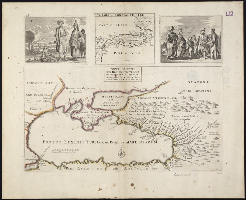
Ponti Euxini cum regionibus versus septentrionem et orientem adjacentibus nova tabula ano: 1672
Item Information
- Title:
- Ponti Euxini cum regionibus versus septentrionem et orientem adjacentibus nova tabula ano: 1672
- Title (alt.):
-
Collection of old maps
- Creator:
- Chardin, John, Sir, 1643-1713
- Name on Item:
-
a Joan: Chardin.
- Date:
-
[1672]
- Format:
-
Maps/Atlases
- Location:
-
Boston Public Library
Norman B. Leventhal Map Center - Collection (local):
-
Norman B. Leventhal Map Center Collection
- Subjects:
-
Black Sea--Maps--Early works to 1800
Istanbul (Turkey)--Maps--Early works to 1800
- Places:
-
Turkeyİstanbul (province)Istanbul
Black Sea
- Extent:
- 1 map : hand col. ; 28 x 53 cm, on sheet 53 x 65 cm.
- Terms of Use:
-
No known copyright restrictions.
No known restrictions on use.
- Publisher:
-
S.l :
s.n.
- Scale:
-
Scale [ca. 1:2,400,000]
- Language:
-
Latin
- Notes:
-
Map of the Black Sea and vicinity.
Relief shown pictorially.
Includes ancillary map above main map: The Golf of Constantinople, and two illustrations of figures in native dress.
Cataloging, conservation, and digitization made possible in part by The National Endowment for the Humanities: Exploring the human endeavor.
Part of composite portfolio atlas with title "Collection of old maps."
- Notes (date):
-
This date is inferred.
- Identifier:
-
06_01_009390
- Call #:
-
G1015 .C65 1630
- Barcode:
-
30000003859199


