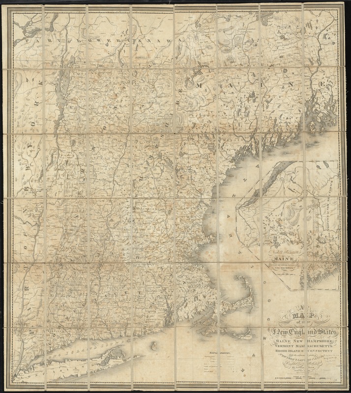
A map of the New England states : Maine, New Hampshire, Vermont, Massachusetts, Rhode Island & Connecticut, with the adjacent parts of New York & lower Canada
Item Information
- Title:
- A map of the New England states : Maine, New Hampshire, Vermont, Massachusetts, Rhode Island & Connecticut, with the adjacent parts of New York & lower Canada
- Creator:
- Hale, Nathan, 1784-1863
- Name on Item:
-
compiled and published by Nathan Hale ; engraved by J.V.N. Throop.
- Date:
-
1826
- Format:
-
Maps/Atlases
- Location:
-
Boston Public Library
Norman B. Leventhal Map Center - Collection (local):
-
Norman B. Leventhal Map Center Collection
- Subjects:
-
New England--Maps
- Places:
-
New England (area)
- Extent:
- 1 map : hand col., dissected and mounted on linen ; 109 x 95 cm.
- Terms of Use:
-
No known copyright restrictions.
No known restrictions on use.
- Publisher:
-
Boston :
Nathan Hale
- Scale:
-
Scale [ca. 1:520,000]
- Language:
-
English
- Notes:
-
Inset: Northern & eastern part of Maine and part of lower Canada and New Brunswick. Scale [ca. 1:1,267,200].
Relief shown by hachures.
- Identifier:
-
06_01_008649
- Call #:
-
G3720 1826 .H35x
- Barcode:
-
39999065655936


