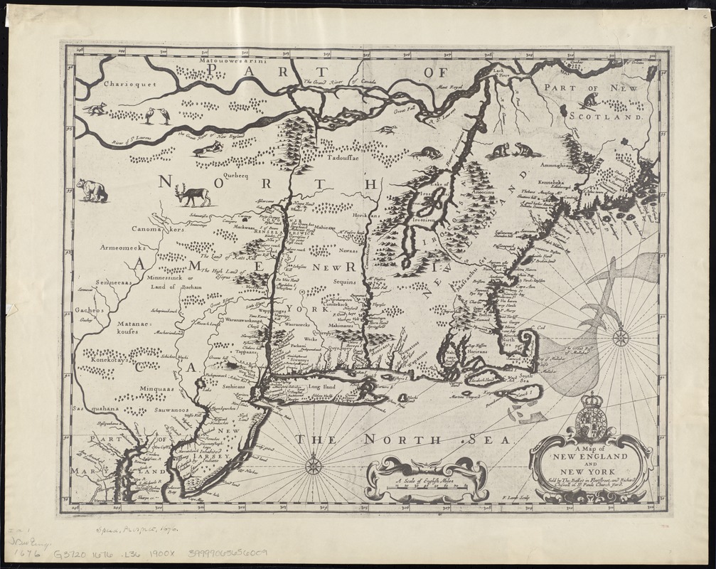
A map of New England and New York
Item Information
- Title:
- A map of New England and New York
- Creator:
- Lamb, Francis.
- Name on Item:
-
F. Lamb sculp.
- Date:
-
[1900–1999]
- Format:
-
Maps/Atlases
- Location:
-
Boston Public Library
Norman B. Leventhal Map Center - Collection (local):
-
Norman B. Leventhal Map Center Collection
- Subjects:
-
New England--Maps--Early works to 1800--Facsimiles
New York (State)--Maps--Early works to 1800--Facsimiles
New Jersey--Maps--Early works to 1800--Facsimiles
1676
- Places:
-
New England (area)
New York
New Jersey
- Extent:
- 1 map ; 37 x 49 cm.
- Terms of Use:
-
No known copyright restrictions.
No known restrictions on use.
- Publisher:
-
S.l :
s.n.
- Scale:
-
Scale [ca. 1:1,960,000]
- Language:
-
English
- Notes:
-
Also covers New Jersey.
Relief shown pictorially.
Photocopy.
From John Speed's atlas, The theatre of the empire of Great Britain, London, 1676.
Includes ill. of animals and coat of arms.
Original version: [London] : Sold by Tho. Basset in Fleetstreet and Richard Chiswell in St. Pauls Church Yard, [1676].
- Notes (date):
-
This date is inferred.
- Identifier:
-
06_01_008647
- Call #:
-
G3720 1676 .L36 1900x
- Barcode:
-
39999065656009