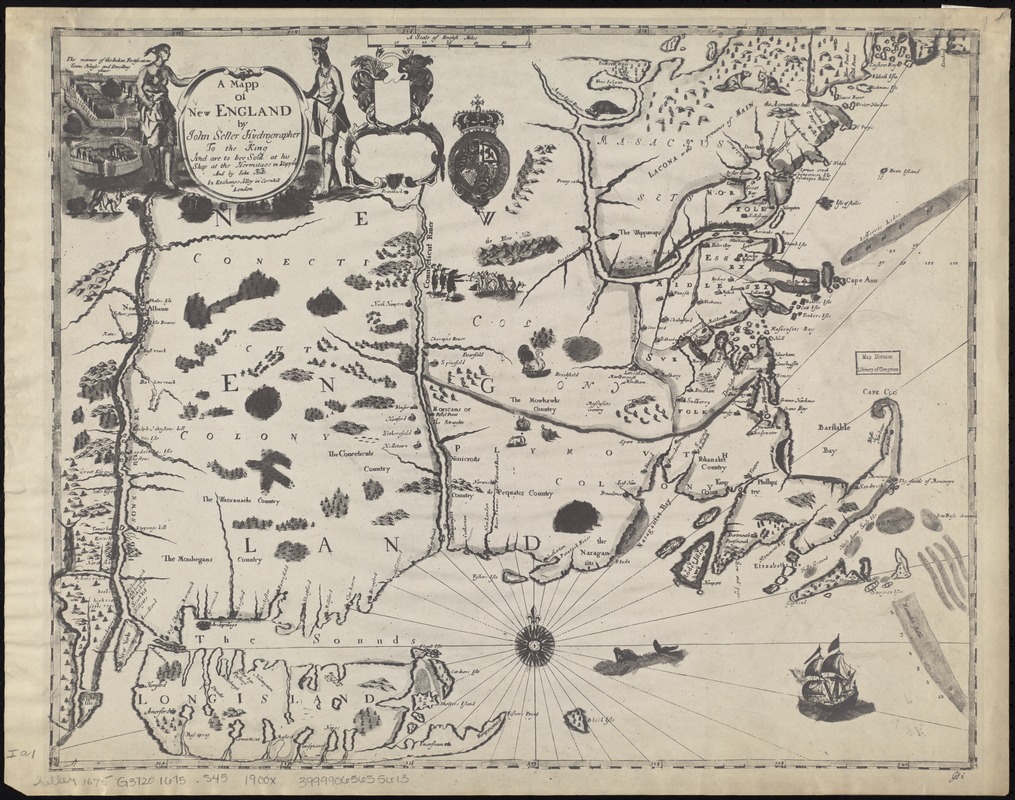
A mapp of New England
Item Information
- Title:
- A mapp of New England
- Creator:
- Seller, John, fl. 1658-1698
- Name on Item:
-
by John Seller, hydrographer to the King.
- Date:
-
[1900–1999]
- Format:
-
Maps/Atlases
- Location:
-
Boston Public Library
Norman B. Leventhal Map Center - Collection (local):
-
Norman B. Leventhal Map Center Collection
- Subjects:
-
New England--Maps--Early works to 1800
- Places:
-
New England (area)
- Extent:
- 1 map ; 42 x 52 cm.
- Terms of Use:
-
No known copyright restrictions.
No known restrictions on use.
- Publisher:
-
S.l :
s.n.
- Scale:
-
Scale [ca. 1:1,040,000]
- Language:
-
English
- Notes:
-
Covers New England from the Penobscot River (Maine) region in the east to the Hudson River (New York) region in the west, incorporating all of the New England Seacoast and including Long Island and States (Staten) Island.
Photocopy.
Relief shown by pictorially. Depths shown by soundings and shading.
Appears in author's Atlas maritimus, or, The sea-atlas, 1675.
Original version: London : His Shop at the Hermitage in Wapping, [1675].
- Notes (date):
-
This date is inferred.
- Identifier:
-
06_01_008648
- Call #:
-
G3720 1675 .S45 1900x
- Barcode:
-
39999065655613


