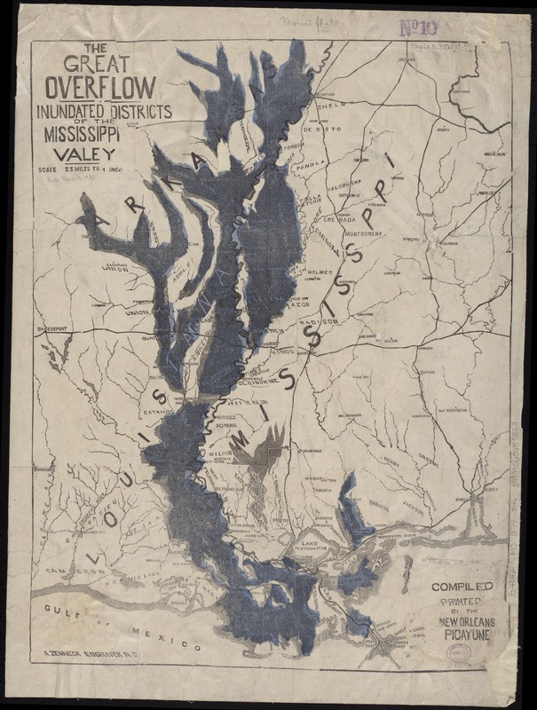
The great overflow : inundated districts of the Mississippi Valey [sic]
Item Information
- Title:
- The great overflow : inundated districts of the Mississippi Valey [sic]
- Creator:
- Zenneck, A.
- Name on Item:
-
A. Zenneck, Engraver, N.O.
- Date:
-
[1874]
- Format:
-
Maps/Atlases
- Location:
-
Boston Public Library
Norman B. Leventhal Map Center - Collection (local):
-
Norman B. Leventhal Map Center Collection
- Subjects:
-
Hydrography--Mississippi River Valley--Maps
Mississippi River--Maps
- Places:
-
Mississippi River
- Extent:
- 1 map : hand col. ; 50 x 39 cm.
- Terms of Use:
-
No known copyright restrictions.
No known restrictions on use.
- Publisher:
-
New Orleans :
New Orleans Picayune
- Scale:
-
Scale [ca. 1:158,400]. 2.5 miles to 1 inch
- Language:
-
English
- Notes (date):
-
This date is inferred.
- Identifier:
-
06_01_008636
- Call #:
-
G4042.M5 1874 .Z46
- Barcode:
-
39999065655803
- LCCN:
-
2007633730


